Potamia, Elassona
Potamia
Ποταμιά | |
|---|---|
 Potamia Location within the regional unit 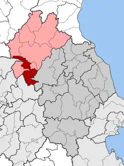 | |
| Coordinates: 39°41′N 22°04′E / 39.683°N 22.067°E | |
| Country | Greece |
| Administrative region | Thessaly |
| Regional unit | Larissa |
| Municipality | Elassona |
| Area | |
| • Municipal unit | 200.28 km2 (77.33 sq mi) |
| Population (2021)[1] | |
| • Municipal unit | 3,139 |
| • Municipal unit density | 16/km2 (41/sq mi) |
| Time zone | UTC+2 (EET) |
| • Summer (DST) | UTC+3 (EEST) |
| Vehicle registration | ΡΙ |
Potamia (Greek: Ποταμιά) is a former municipality in the Larissa regional unit, Thessaly, Greece. Since the 2011 local government reform it is part of the municipality Elassona, of which it is a municipal unit.[2] Population 3,139 (2021). The municipal unit has an area of 200.279 km2.[3] The seat of the municipality was in Vlachogianni. The name of the municipality comes from the greek word "potamià" meaning "land with many rivers" (from potamòs, river).
References
- ^ "Αποτελέσματα Απογραφής Πληθυσμού - Κατοικιών 2021, Μόνιμος Πληθυσμός κατά οικισμό" [Results of the 2021 Population - Housing Census, Permanent population by settlement] (in Greek). Hellenic Statistical Authority. 29 March 2024.
- ^ "ΦΕΚ B 1292/2010, Kallikratis reform municipalities" (in Greek). Government Gazette.
- ^ "Population & housing census 2001 (incl. area and average elevation)" (PDF) (in Greek). National Statistical Service of Greece.