Puerto Rico Highway 130
 Highway 130 | ||||
|---|---|---|---|---|
| Ruta 130 | ||||
| Carretera Estatal Carlos Romero Barceló[1] | ||||
| Route information | ||||
| Maintained by Puerto Rico DTPW | ||||
| Length | 12.1 km[2] (7.5 mi) | |||
| Existed | 1953[3]–present | |||
| Major junctions | ||||
| South end | ||||
| ||||
| North end | ||||
| Location | ||||
| Country | United States | |||
| Territory | Puerto Rico | |||
| Municipalities | Hatillo | |||
| Highway system | ||||
| ||||
Puerto Rico Highway 130 (PR-130) is the main north–south route within the municipality of Hatillo, Puerto Rico. This road extends from PR-119 in downtown Hatillo to PR-129 in Campo Alegre barrio.[4]
Route description
The highway starts from the downtown area (from PR-119), crossing the neighborhoods of Capáez, Naranjito, Buena Vista and Campo Alegre until its end at Carretera Mariana Bracetti (PR-129).[5] In downtown, the highway runs through Calle Luis H. Lacomba and Avenida Pablo J. Aguilar until it crosses PR-2 in a southerly direction. This route is part of the caravan of the Hatillo Mask Festival.
-
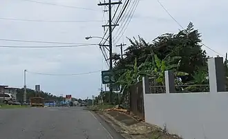
 Puerto Rico highway 130 heading north
 -
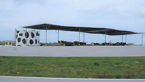 One of many dairy farms located along PR-130
Communities served
The following are the barrios through which PR-130 passes from north to south:[2]
- Hatillo barrio-pueblo
- Hatillo barrio
- Capáez
- Naranjito
- Buena Vista (northeast corner)
- Corcovado (southwest corner)
- Campo Alegre
Major intersections
The entire route is located in Hatillo.
-
 PR-488 and PR-130 junction in Hatillo
 -
 PR-130 north at PR-492 intersection
 -
 "Hatillo Mask Festival" statue located at downtown entrance
 -
.jpg) PR-2 west at PR-130 junction in downtown Hatillo
PR-2 west at PR-130 junction in downtown Hatillo
| Location | km[2] | mi | Destinations | Notes | |
|---|---|---|---|---|---|
| Campo Alegre | 12.1 | 7.5 | Southern terminus of PR-130 | ||
| Buena Vista–Naranjito– Campo Alegre–Corcovado quadripoint | 8.7 | 5.4 | |||
| Buena Vista–Naranjito line | 8.0 | 5.0 | |||
| Naranjito | 6.2 | 3.9 | |||
| Naranjito–Capáez line | 5.0 | 3.1 | |||
| Hatillo barrio-pueblo | 0.5 | 0.31 | |||
| 0.0 | 0.0 | Northern terminus of PR-130 | |||
| 1.000 mi = 1.609 km; 1.000 km = 0.621 mi | |||||
See also
References
- ^ "Pueden pasarle por encima a Romero Barceló - NOTICEL". NotiCel - La verdad como es - Noticias de Puerto Rico - NOTICEL (in Spanish). Retrieved 10 April 2019.
- ^ a b c "PR-130" (Map). Google Maps. Retrieved 2 March 2020.
- ^ "Hatillo, Memoria Núm. 63" (PDF). Puerto Rico Planning Board (in Spanish). 1954. Retrieved 4 August 2020.
- ^ National Geographic Maps (2011). Puerto Rico (Map). 1:125,000. Adventure Map (Book 3107). Evergreen, Colorado: National Geographic Maps. ISBN 978-1566955188. OCLC 756511572.
- ^ Puerto Rico Department of Transportation and Public Works. "Datos de Transito 2000-2009" (in Spanish). Archived from the original on 1 April 2019. Retrieved 24 March 2019.
External links
 Media related to Puerto Rico Highway 130 at Wikimedia Commons