Puerto Rico Highway 131
 Highway 131 | ||||
|---|---|---|---|---|
| Ruta 131 | ||||
| Route information | ||||
| Maintained by Puerto Rico DTPW | ||||
| Length | 8.0 km[1] (5.0 mi) | |||
| Existed | 1953[2]–present | |||
| Major junctions | ||||
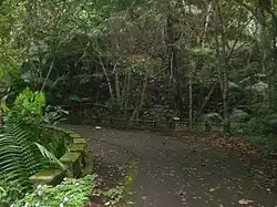
| South end | Guilarte Forest in Guilarte | |||
| North end | ||||
| Location | ||||
| Country | United States | |||
| Territory | Puerto Rico | |||
| Municipalities | Adjuntas | |||
| Highway system | ||||
| ||||
| ||||
Puerto Rico Highway 131 (PR-131) is a road located in Adjuntas, Puerto Rico.[3] It begins at its intersection with PR-135 in Barrio Yayales and ends at Guilarte Forest near Peñuelas municipal limit. Its segment between PR-525 and PR-518 is part of the Ruta Panorámica.[4][5]
Major intersections
The entire route is located in Adjuntas.
| Location | km[1] | mi | Destinations | Notes | |
|---|---|---|---|---|---|
| Guilarte | 8.0 | 5.0 | Southern terminus of PR-131 at Guilarte Forest; dead end road | ||
| 7.9 | 4.9 | Southern terminus of the Ruta Panorámica concurrency | |||
| 4.1 | 2.5 | Northern terminus of the Ruta Panorámica concurrency | |||
| Yayales | 0.0 | 0.0 | Northern terminus of PR-131 | ||
1.000 mi = 1.609 km; 1.000 km = 0.621 mi
| |||||
Related route
Highway 3131 | |
|---|---|
| Location | Guayanilla – Peñuelas |
| Length | 5.3 km[6] (3.3 mi) |
Puerto Rico Highway 3131 (PR-3131) is a rural road that branches off from PR-132 in eastern Guayanilla and ends near Sector Malpaso in Peñuelas.[3]
| Municipality | Location | km[6] | mi | Destinations | Notes |
|---|---|---|---|---|---|
| Guayanilla | Barrero | 0.0 | 0.0 | Southern terminus of PR-3131 | |
| Peñuelas | Santo Domingo | 5.3 | 3.3 | Northern terminus of PR-3131 at Sector Malpaso | |
| 1.000 mi = 1.609 km; 1.000 km = 0.621 mi | |||||
See also
References
- ^ a b "PR-131" (Map). Google Maps. Retrieved 2 March 2020.
- ^ "Adjuntas, Memoria Núm. 67" (PDF). Puerto Rico Planning Board (in Spanish). 1955. Retrieved 4 August 2020.
- ^ a b National Geographic Maps (2011). Puerto Rico (Map). 1:125,000. Adventure Map (Book 3107). Evergreen, Colorado: National Geographic Maps. ISBN 978-1566955188. OCLC 756511572.
- ^ "Caminata panorámica". Deconews.info (in Spanish). Retrieved 22 May 2019.
- ^ "Map of Adjuntas at the Wayback Machine" (PDF). Archived from the original (PDF) on 17 April 2015. Retrieved 29 December 2018.
- ^ a b "PR-3131" (Map). Google Maps. Retrieved 2 March 2020.
External links
Wikimedia Commons has media related to Puerto Rico Highway 131 and Puerto Rico Highway 3131.