Purcell, Kansas
Purcell, Kansas | |
|---|---|
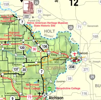 KDOT map of Doniphan County (legend) | |
 Purcell  Purcell | |
| Coordinates: 39°40′50″N 95°19′51″W / 39.68056°N 95.33083°W[1] | |
| Country | United States |
| State | Kansas |
| County | Doniphan |
| Founded | 1886 |
| Named after | John Purcell |
| Elevation | 1,139 ft (347 m) |
| Time zone | UTC-6 (CST) |
| • Summer (DST) | UTC-5 (CDT) |
| Area code | 785 |
| FIPS code | 20-57950 |
| GNIS ID | 473266 [1] |
Purcell is an unincorporated community in Doniphan County, Kansas, United States.[1] It is located 5 miles (8.0 km) east of Everest, south of K-20, on highway K-137.
History
Purcell was founded about 1886.[2] John Purcell was one of the earliest settlers.[3]
A post office was opened in Purcell in 1887, and remained in operation until it was discontinued in 1956.[4]
St. Mary's Catholic Church, which is listed on the National Register of Historic Places, is located in Purcell.[5]
References
- ^ a b c d "Purcell, Kansas", Geographic Names Information System, United States Geological Survey, United States Department of the Interior
- ^ Blackmar, Frank Wilson (1912). Kansas: A Cyclopedia of State History, Volume 2. Standard Publishing Company. pp. 523.
- ^ Gray, Patrick Leopoldo (1905). Gray's Doniphan County History: A Record of the Happenings of Half a Hundred Years. Roycroft Press. pp. 64.
- ^ "Kansas Post Offices, 1828-1961 (archived)". Kansas Historical Society. Archived from the original on October 9, 2013. Retrieved June 8, 2014.
- ^ "National Register Information System". National Register of Historic Places. National Park Service. July 9, 2010.
Further reading
External links
Municipalities and communities of Doniphan County, Kansas, United States | ||
|---|---|---|
| Cities |  | |
| CDPs | ||
| Unincorporated communities | ||
| Ghost towns | ||
| Indian reservations | ||
| Townships | ||
| Footnotes | ‡This populated place also has portions in an adjacent county or counties | |