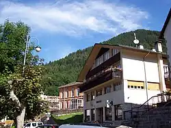
Ravascletto
Ravascletto
| |
|---|---|
| Comune di Ravascletto | |
Location of Ravascletto | |
 Ravascletto Location of Ravascletto in Italy 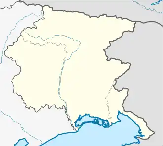 Ravascletto Ravascletto (Friuli-Venezia Giulia) | |
| Coordinates: 46°32′N 12°55′E / 46.533°N 12.917°E | |
| Country | Italy |
| Region | Friuli-Venezia Giulia |
| Province | Udine (UD) |
| Frazioni | Ravascletto, Zovello, Salârs |
| Government | |
| • Mayor | Flavio De Stalis (Floridura di Ravasclêt 3) |
| Area | |
• Total | 26.3 km2 (10.2 sq mi) |
| Population (Dec. 2004)[2] | |
• Total | 601 |
| • Density | 23/km2 (59/sq mi) |
| Demonym | moneans (Friulian) |
| Time zone | UTC+1 (CET) |
| • Summer (DST) | UTC+2 (CEST) |
| Postal code | 33020 |
| Dialing code | 0433 |
| Saint day | Pentecost Monday |
| Website | http://www.altofriuli.net/altofriuli/ravascletto/home.nsf |
Ravascletto (Friulian: Monai or Ravasclêt) is a comune (municipality) in the Regional decentralization entity of Udine in the Italian region of Friuli-Venezia Giulia, located about 120 kilometres (75 mi) northwest of Trieste and about 60 kilometres (37 mi) northwest of Udine. As of 31 December 2004, it had a population of 601 and an area of 26.3 square kilometres (10.2 sq mi).[3]
Ravascletto borders the following municipalities: Cercivento, Comeglians, Ovaro, Paluzza, Sutrio.
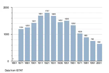
Demographic evolution
References
- ^ "Superficie di Comuni Province e Regioni italiane al 9 ottobre 2011". Italian National Institute of Statistics. Retrieved 16 March 2019.
- ^ "Popolazione Residente al 1° Gennaio 2018". Italian National Institute of Statistics. Retrieved 16 March 2019.
- ^ All demographics and other statistics: Italian statistical institute Istat.
External links
![]() Media related to Ravascletto at Wikimedia Commons
Media related to Ravascletto at Wikimedia Commons