Rhederbrug
Rhederbrug | |
|---|---|
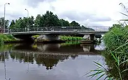 Rheder Bridge in 2008 | |
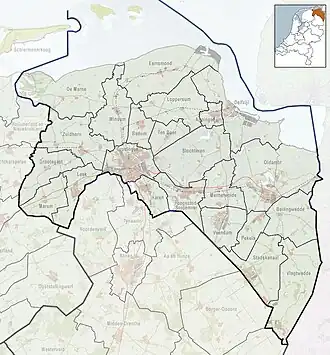 Rhederbrug Location of Rhederbrug in the province of Groningen  Rhederbrug Rhederbrug (Netherlands) | |
| Coordinates: 53°5′20″N 7°10′5″E / 53.08889°N 7.16806°E | |
| Country | Netherlands |
| Province | Groningen |
| Municipality | Westerwolde |
| Village | Bellingwolde |
| Area | |
• Total | 7.33 km2 (2.83 sq mi) |
| Elevation | 0.8 m (2.6 ft) |
| Population (2021)[1] | |
• Total | 240 |
| • Density | 33/km2 (85/sq mi) |
| Postal code | 9695[1] |
| Dialing code | 0597 |
Rhederbrug (Dutch pronunciation: [ˌreːdərˈbrʏx]; English: Rhede's Bridge) is a hamlet near Bellingwolde in the municipality of Westerwolde in the Netherlands. The hamlet has a population of 240.[1]
The hamlet was first mentioned in 1983 as Rhederbrug, and means bridge to Rhede in Germany. The bridge was built around 1917.[3] Rhederbrug is considered part of Bellingwolde.[4]
References
- ^ a b c d "Kerncijfers wijken en buurten 2021". Central Bureau of Statistics. Retrieved 9 April 2022.
two entries
- ^ "Postcodetool for 9695AA". Actueel Hoogtebestand Nederland (in Dutch). Het Waterschapshuis. Retrieved 8 April 2022.
- ^ "Rhederbrug - (geografische naam)". Etymologiebank (in Dutch). Retrieved 9 April 2022.
- ^ "Rhederbrug". Plaatsengids (in Dutch). Retrieved 9 April 2022.
External links
 Media related to Rhederbrug at Wikimedia Commons