Ter Apelkanaal
Ter Apelkanaal | |
|---|---|
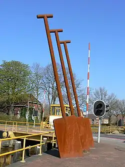 Sculpture in Ter Apelkanaal | |
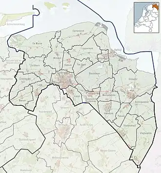 Ter Apelkanaal Location in the province of Groningen in the Netherlands  Ter Apelkanaal Ter Apelkanaal (Netherlands) | |
| Coordinates: 52°55′4″N 7°2′27″E / 52.91778°N 7.04083°E | |
| Country | Netherlands |
| Province | Groningen |
| Municipality | Westerwolde |
| Area | |
• Total | 2.06 km2 (0.80 sq mi) |
| Elevation | 11 m (36 ft) |
| Population (2021)[1] | |
• Total | 660 |
| • Density | 320/km2 (830/sq mi) |
| Time zone | UTC+1 (CET) |
| • Summer (DST) | UTC+2 (CEST) |
| Postal code | 9563 |
| Dialing code | 0599 |
Ter Apelkanaal (Gronings: Troapelknoal [ˌtrʊːpl̩ˈknʊːl]) is a town in the Dutch province of Groningen. It is a part of the municipality of Westerwolde, and lies about 17 km (11 mi) northeast of Emmen.
The city of Groningen decided to dig a canal along the border with Drenthe to exploit the peat. The canal was finished in 1856 and named Ter Apelkanaal and the settlement was named after the canal.[3]
On 1902, construction started of a potato starch factory "Musselkanaal en Omstreken" in Ter Apelkanaal.[4] The factory is nowadays owned by Royal Avebe.[3]
Ter Apelkanaal used to be part of Vlagtwedde. In 2017, it was merged into Westerwolde.[3]
References
- ^ a b "Kerncijfers wijken en buurten 2021". Central Bureau Statistics. Retrieved 1 March 2022.
- ^ "Postcodetool for 9563PA". Actueel Hoogtebestand Nederland (in Dutch). Het Waterschapshuis. Archived from the original on 21 September 2013. Retrieved 1 March 2022.
- ^ a b c "Ter Apelkanaal". Plaatsengids (in Dutch). Retrieved 1 March 2022.
- ^ "No 1345". Akten betreffende coöperatieve vereenigingen (in Dutch). 20 February 1904. Retrieved 1 March 2022.
Wikimedia Commons has media related to Ter Apelkanaal.