Rietbron
Rietbron | |
|---|---|
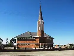 Dutch Reformed Church Rietbron | |
 Rietbron  Rietbron | |
| Coordinates: 32°53′56″S 23°08′56″E / 32.899°S 23.149°E | |
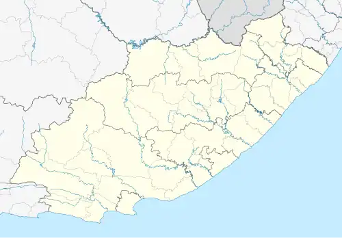
| Country | South Africa |
| Province | Eastern Cape |
| District | Sarah Baartman |
| Municipality | Dr Beyers Naudé |
| Area | |
• Total | 18.29 km2 (7.06 sq mi) |
| Population (2011)[1] | |
• Total | 1,184 |
| • Density | 65/km2 (170/sq mi) |
| Racial makeup (2011) | |
| • Black African | 7.8% |
| • Coloured | 87.6% |
| • Indian/Asian | 0.4% |
| • White | 3.4% |
| • Other | 0.8% |
| First languages (2011) | |
| • Afrikaans | 96.3% |
| • English | 1.6% |
| • Other | 2.1% |
| Time zone | UTC+2 (SAST) |
| PO box | 6450 |
| Area code | 044 |
Rietbron is a town in Sarah Baartman District Municipality in the Eastern Cape province of South Africa. It is on the R306 road.
Village 85 km south-east of Beaufort West and 64 km north-west of Willowmore. The name is Afrikaans and means ‘reed source’, ‘reed fountain’.[2]
References
- ^ a b c d "Main Place Rietbron". Census 2011.
- ^ "Dictionary of Southern African Place Names (Public Domain)". Human Science Research Council. p. 387.
External links
 Media related to Rietbron at Wikimedia Commons
Municipalities and communities of Sarah Baartman District Municipality, Eastern Cape | ||
|---|---|---|
District seat: Port Elizabeth (Gqeberha) | ||
| Blue Crane Route |
| .svg.png) |
| Dr Beyers Naudé | ||
| Kouga | ||
| Kou-Kamma | ||
| Makana |
| |
| Ndlambe | ||
| Sunday's River Valley | ||