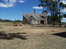
Waterford, Eastern Cape
Waterford | |
|---|---|
 | |
 Waterford  Waterford | |
| Coordinates: 33°05′16.62″S 25°02′37.75″E / 33.0879500°S 25.0438194°E | |
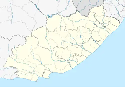
| Country | South Africa |
| Province | Eastern Cape |
| District | Beyers Naudé |
| Area | |
• Total | 26.74 km2 (10.32 sq mi) |
| Population (2011)[2] | |
• Total | 40 |
| • Density | 1.5/km2 (3.9/sq mi) |
| Racial makeup (2011) | |
| • Black African | 15% |
| • Coloured | 68% |
| • White | 17% |
| • Other | 0.2% |
| First languages (2011) | |
| • Xhosa | 22% |
| • Afrikaans | 70% |
| • Sotho | 5.00% |
| • Other | 2.5% |
Waterford is a small town in the Eastern Cape established to provide services to the farming community. Since August 2016, the town falls within the Dr Beyers Naudé Local Municipality.[3]
References
- ^ "Census 2011: Main Place: Waterford".
- ^ a b c Cite error: The named reference
census2011was invoked but never defined (see the help page). - ^ "Waterford Village".
Bibliography
- Logie, Bartle: Sundays – tales from a winding river. Port Elizabeth: Bluecliff, 2011. ISBN 978-0-9870017-2-6
Municipalities and communities of Sarah Baartman District Municipality, Eastern Cape | ||
|---|---|---|
District seat: Port Elizabeth (Gqeberha) | ||
| Blue Crane Route |
| .svg.png) |
| Dr Beyers Naudé | ||
| Kouga | ||
| Kou-Kamma | ||
| Makana |
| |
| Ndlambe | ||
| Sunday's River Valley | ||