Rudná pod Pradědem
Rudná pod Pradědem | |
|---|---|
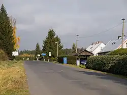 Main road in Stará Rudná | |
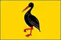 Flag  Coat of arms | |
 Rudná pod Pradědem Location in the Czech Republic | |
| Coordinates: 50°1′6″N 17°20′41″E / 50.01833°N 17.34472°E | |
| Country | |
| Region | Moravian-Silesian |
| District | Bruntál |
| First mentioned | 1377 |
| Area | |
• Total | 21.82 km2 (8.42 sq mi) |
| Elevation | 600 m (2,000 ft) |
| Population (2025-01-01)[1] | |
• Total | 359 |
| • Density | 16/km2 (43/sq mi) |
| Time zone | UTC+1 (CET) |
| • Summer (DST) | UTC+2 (CEST) |
| Postal code | 793 31 |
| Website | www |
Rudná pod Pradědem (until 1947 Vogelzejf; German: Vogelseifen) is a municipality in Bruntál District in the Moravian-Silesian Region of the Czech Republic. It has about 400 inhabitants.
Administrative division
Rudná pod Pradědem consists of two municipal parts (in brackets population according to the 2021 census):[2]
- Nová Rudná (37)
- Stará Rudná (330)
Demographics
| Year | Pop. | ±% |
|---|---|---|
| 1869 | 1,145 | — |
| 1880 | 1,180 | +3.1% |
| 1890 | 1,123 | −4.8% |
| 1900 | 1,063 | −5.3% |
| 1910 | 1,016 | −4.4% |
| 1921 | 933 | −8.2% |
| 1930 | 920 | −1.4% |
| 1950 | 434 | −52.8% |
| 1961 | 388 | −10.6% |
| 1970 | 486 | +25.3% |
| 1980 | 458 | −5.8% |
| 1991 | 398 | −13.1% |
| 2001 | 385 | −3.3% |
| 2011 | 369 | −4.2% |
| 2021 | 367 | −0.5% |
| Source: Censuses[3][4] | ||
References
- ^ "Population of Municipalities – 1 January 2025". Czech Statistical Office. 2025-05-16.
- ^ "Public Census 2021 – basic data". Public Database (in Czech). Czech Statistical Office. 2022.
- ^ "Historický lexikon obcí České republiky 1869–2011" (in Czech). Czech Statistical Office. 2015-12-21.
- ^ "Population Census 2021: Population by sex". Public Database. Czech Statistical Office. 2021-03-27.
External links
Wikimedia Commons has media related to Rudná pod Pradědem.