Saint-Symphorien, Belgium
Saint-Symphorien
Sint-Symforyin (Walloon) | |
|---|---|
The village | |
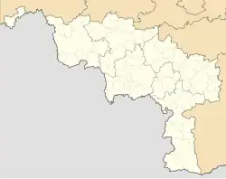
Location of Saint-Symphorien | |
 Location of Saint-Symphorien in Mons | |
 Saint-Symphorien  Saint-Symphorien | |
| Coordinates: 50°26′12″N 4°00′45″E / 50.43667°N 4.01250°E | |
| Country | |
| Community | |
| Region | |
| Province | |
| Arrondissement | Mons |
| Municipality | Mons |
| Area | |
• Total | 7.17 km2 (2.77 sq mi) |
| Population (2020-01-01) | |
• Total | 3,349 |
| • Density | 470/km2 (1,200/sq mi) |
| Postal codes | 7030 |
| Area codes | 065 |
Saint-Symphorien (French pronunciation: [sɛ̃ sɛ̃fɔʁjɛ̃]; Walloon: Sint-Symforyin) is a sub-municipality of the city of Mons located in the province of Hainaut, Wallonia, Belgium. It was a separate municipality until 1977. On 1 January 1977, it was merged into Mons.[1]
Heritage
The village's military cemetery contains about 500 German and Commonwealth graves from the First World War.
Gallery
-
Church
-
Distillery (1854)
-
Place
-
International Military Cemetery, German and British memorial
References
External links
Wikimedia Commons has media related to Saint-Symphorien, Belgium.