Sankt Ulrich bei Steyr
Sankt Ulrich bei Steyr | |
|---|---|
 | |
 Coat of arms | |
 Sankt Ulrich bei Steyr Location within Austria | |
| Coordinates: 48°01′21″N 14°25′01″E / 48.02250°N 14.41694°E | |
| Country | Austria |
| State | Upper Austria |
| District | Steyr-Land |
| Government | |
| • Mayor | Maria Theresia Traunik (ÖVP) |
| Area | |
• Total | 39.03 km2 (15.07 sq mi) |
| Elevation | 377 m (1,237 ft) |
| Population (2018-01-01)[2] | |
• Total | 2,969 |
| • Density | 76/km2 (200/sq mi) |
| Time zone | UTC+1 (CET) |
| • Summer (DST) | UTC+2 (CEST) |
| Postal code | 4400 |
| Area code | 07252 |
| Vehicle registration | SE |
| Website | www.st-ulrich-steyr.ooe.gv.at |
Sankt Ulrich bei Steyr is a municipality in the district of Steyr-Land in the Austrian state of Upper Austria.
Geography
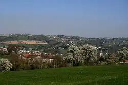
Sankt Ulrich lies in the Traunviertel. About 51 percent of the municipality is forest, and 40 percent is farmland.
Notable locations
- Landgasthof Mayr - continuously run inn founded in 1313, family business today managed by Mr. Christian Mayr
References
- ^ "Dauersiedlungsraum der Gemeinden Politischen Bezirke und Bundesländer - Gebietsstand 1.1.2018". Statistics Austria. Retrieved 10 March 2019.
- ^ "Einwohnerzahl 1.1.2018 nach Gemeinden mit Status, Gebietsstand 1.1.2018". Statistics Austria. Retrieved 9 March 2019.
Wikimedia Commons has media related to Sankt Ulrich bei Steyr.