Sarayönü
Sarayönü | |
|---|---|
District and municipality | |
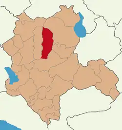 Map showing Sarayönü District in Konya Province | |
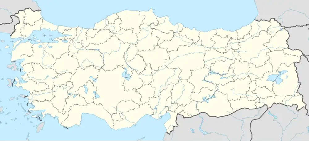 Sarayönü Location in Turkey  Sarayönü Sarayönü (Turkey Central Anatolia) | |
| Coordinates: 38°15′58″N 32°24′23″E / 38.26611°N 32.40639°E | |
| Country | Turkey |
| Province | Konya |
| Government | |
| • Mayor | Necati Koç (YRP) |
Area | 1,620 km2 (630 sq mi) |
| Elevation | 1,050 m (3,440 ft) |
| Population (2022)[1] | 27,771 |
| • Density | 17/km2 (44/sq mi) |
| Time zone | UTC+3 (TRT) |
| Area code | 0332 |
| Website | www |
Sarayönü is a municipality and district of Konya Province, Turkey.[2] Its area is 1,620 km2,[3] and its population is 27,771 (2022).[1] The town occupies the location of the ancient Laodicea Combusta.[4]
Composition
There are 26 neighbourhoods in Sarayönü District:[5]
- Bahçesaray
- Başhüyük
- Batıistasyon
- Boyalı
- Büyükzengi
- Çeşmelisebil
- Değirmenli
- Doğuistasyon
- Ertugrul
- Fatih
- Gözlü
- Hatip
- İnli
- Kadıoğlu
- Karabıyık
- Karatepe
- Kayıören
- Konar
- Kurşunlu
- Kuyulusebil
- Ladik
- Özkent
- Saraç
- Selimiye
- Yenicekaya
- Yukarı
References
- ^ a b "Address-based population registration system (ADNKS) results dated 31 December 2022, Favorite Reports" (XLS). TÜİK. Retrieved 19 September 2023.
- ^ Büyükşehir İlçe Belediyesi, Turkey Civil Administration Departments Inventory. Retrieved 19 September 2023.
- ^ "İl ve İlçe Yüz ölçümleri". General Directorate of Mapping. Retrieved 19 September 2023.
- ^ Breytenbach, Cilliers; Zimmermann, Christiane (December 2017). Early Christianity in Lycaonia and Adjacent Areas From Paul to Amphilochius of Iconium. Brill. ISBN 9789004352520. Retrieved 8 October 2023.
- ^ Mahalle, Turkey Civil Administration Departments Inventory. Retrieved 19 September 2023.
External links
- District municipality's official website (in Turkish)
Sarayönü in Konya Province of Turkey | |||||||||||||||||||||||||||
|---|---|---|---|---|---|---|---|---|---|---|---|---|---|---|---|---|---|---|---|---|---|---|---|---|---|---|---|
| Districts |  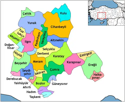 | ||||||||||||||||||||||||||
|
Metropolitan municipalities are bolded. | |||||||||||||||||||||||||||