Saskatchewan Highway 334
.svg.png) Highway 334 | ||||
|---|---|---|---|---|
 Highway 334 | ||||
| Route information | ||||
| Maintained by Ministry of Highways and Infrastructure | ||||
| Length | 95.6 km[1] (59.4 mi) | |||
| Major junctions | ||||
| South end | ||||
| North end | ||||
| Location | ||||
| Country | Canada | |||
| Province | Saskatchewan | |||
| Rural municipalities | Key West, Elmsthorpe, Caledonia, Bratt's Lake | |||
| Highway system | ||||
|
| ||||
| ||||
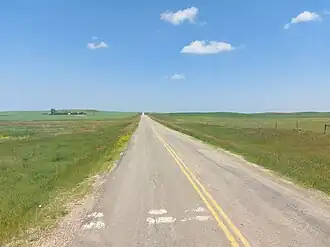
Highway 334 is a provincial highway in the Canadian province of Saskatchewan. It runs from the Highway 13 / Highway 34 junction, approximately 18 kilometres (11 mi) north of Bengough and 16 kilometres (10 mi) west of Ogema, north to Highway 6 / Highway 39 at Corinne. The highway is about 96 kilometres (60 mi)[1] long and passes through the communities of Avonlea[2] and Kayville.
Major intersections
From south to north:[3]
| Rural municipality | Location | km[1] | mi | Destinations | Notes | |||
|---|---|---|---|---|---|---|---|---|
| Key West | | 0.0 | 0.0 | |||||
| | 17.5 | 10.9 | ||||||
| Kayville | 20.8 | 12.9 | Township Road 92 | |||||
| Elmsthorpe | Avonlea | 62.0 | 38.5 | Hwy 334 branches east; directional signage changes | ||||
| | 68.5 | 42.6 | West end of Hwy 623 concurrency | |||||
| | 70.2 | 43.6 | East end of Hwy 623 concurrency | |||||
| Caledonia |
No major junctions | |||||||
| Caledonia–Bratt's Lake line | Corinne | 95.6 | 59.4 | 4th Base Line | ||||
1.000 mi = 1.609 km; 1.000 km = 0.621 mi
| ||||||||
See also
References
- ^ a b c "HIghway 334 in Saskatchewan" (Map). Google Maps. Retrieved 5 February 2018.
- ^ "South - Avonlea - Hwys 334, 339". Tourism Saskatchewan. Government of Saskatchewan. Retrieved 23 July 2024.
- ^ MapArt (2007). Saskatchewan Road Atlas (Map) (2007 ed.). 1:540,000. Oshawa, Ontario: Peter Heiler Ltd. pp. 42, 49, 50. ISBN 1-55368-020-0.