Schönwald, Brandenburg
Schönwald | |
|---|---|
Location of Schönwald within Dahme-Spreewald district 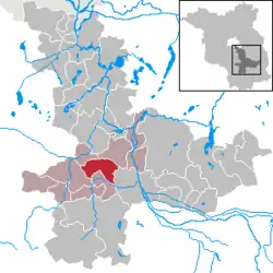 | |
 Schönwald 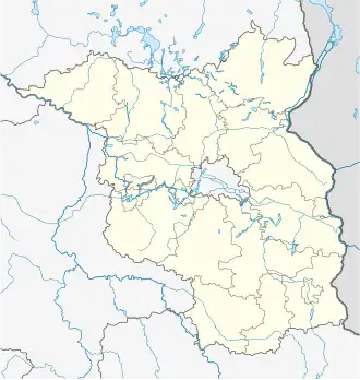 Schönwald | |
| Coordinates: 51°59′N 13°42′E / 51.983°N 13.700°E | |
| Country | Germany |
| State | Brandenburg |
| District | Dahme-Spreewald |
| Municipal assoc. | Unterspreewald |
| Subdivisions | 2 Ortsteile |
| Government | |
| • Mayor (2024–29) | Roland Gefreiter[1] |
| Area | |
• Total | 44.85 km2 (17.32 sq mi) |
| Elevation | 53 m (174 ft) |
| Population (2023-12-31)[2] | |
• Total | 1,207 |
| • Density | 27/km2 (70/sq mi) |
| Time zone | UTC+01:00 (CET) |
| • Summer (DST) | UTC+02:00 (CEST) |
| Postal codes | 15910 |
| Dialling codes | 035474 |
| Vehicle registration | LDS |
| Website | www.unterspreewald.de |
Schönwald is a municipality in the district of Dahme-Spreewald in Brandenburg in Germany.
History
The present Schönwald as an entity was created from the voluntary merger of two previously independent municipalities, Schönwalde (Lower Sorbian Běły Gózd) und Waldow-Brand. Today it is in the jurisdiction of the district of Unterspreewald, the seat of which is itself in Schönwald.
Demography
.pdf.jpg)
|
|
|
References
- ^ Landkreis Dahme-Spreewald Wahl der Bürgermeisterin / des Bürgermeisters. Retrieved 10 July 2024.
- ^ "Bevölkerungsstand im Land Brandenburg Dezember 2023] (Fortgeschriebene amtliche Einwohnerzahlen, basierend auf dem Zensus 2022)". Amt für Statistik Berlin-Brandenburglanguage=German.
- ^ Detailed data sources are to be found in the Wikimedia Commons.Population Projection Brandenburg at Wikimedia Commons