Segonzano
Segonzano | |
|---|---|
| Comune di Segonzano | |
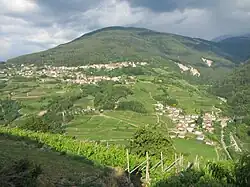 View from the nearby Faver | |
Location of Segonzano | |
 Segonzano Location of Segonzano in Italy 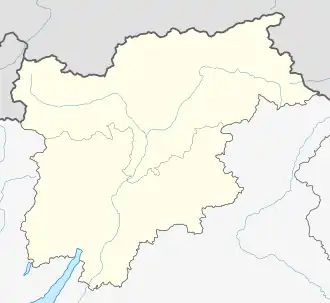 Segonzano Segonzano (Trentino-Alto Adige/Südtirol) | |
| Coordinates: 46°11′N 11°16′E / 46.183°N 11.267°E | |
| Country | Italy |
| Region | Trentino-Alto Adige/Südtirol |
| Province | Trentino (TN) |
| Government | |
| • Mayor | Pierangelo Villaci |
| Area | |
• Total | 20.72 km2 (8.00 sq mi) |
| Elevation | 700 m (2,300 ft) |
| Population (31 October 2021)[2] | |
• Total | 1,384 |
| • Density | 67/km2 (170/sq mi) |
| Demonym | [3] |
| Time zone | UTC+1 (CET) |
| • Summer (DST) | UTC+2 (CEST) |
| Postal code | 38047 |
| Dialing code | 0461 |
| Website | Official website |
Segonzano (Segonzàn in local dialect) is a comune (municipality) in Trentino in the northern Italian region Trentino-Alto Adige/Südtirol, located about 15 kilometres (9 mi) northeast of Trento.
Main sights
- Castle, only partially preserved. It was damaged during a local battle between French and Austrian troops in 1796.
- Sanctuary of Madonna dell'Aiuto
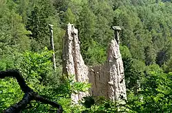
- The "Piramidi di Terra", natural pyramids created by erosion.
References
- ^ "Superficie di Comuni Province e Regioni italiane al 9 ottobre 2011". Italian National Institute of Statistics. Retrieved 16 March 2019.
- ^ "Popolazione Residente al 1° Gennaio 2018". Italian National Institute of Statistics. Retrieved 16 March 2019.
- ^ All demographics and other statistics: Italian statistical institute Istat.