Sheridan, Kansas
Sheridan, Kansas | |
|---|---|
 KDOT map of Sheridan County (legend) | |
 Sheridan  Sheridan | |
| Coordinates: 39°30′33″N 100°29′52″W / 39.50917°N 100.49778°W | |
| Country | United States |
| State | Kansas |
| County | Sheridan |
| Elevation | 2,743 ft (836 m) |
| Population | |
• Total | 0 |
| Time zone | UTC-6 (CST) |
| • Summer (DST) | UTC-5 (CDT) |
| Area code | 785 |
| GNIS ID | 482587[1] |
Sheridan is a ghost town in Sheridan County, Kansas, United States.
History
Sheridan was issued a post office in 1876. The post office was discontinued in 1888.[2]
The Denver Extension of the Kansas Pacific Railroad was completed near Sheridan in 1868.
-
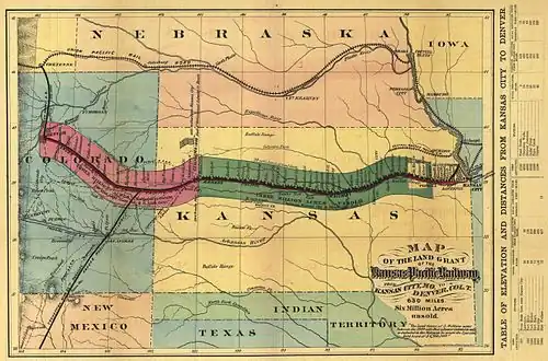 Kansas Pacific Railroad completes the Denver Extension
References
- ^ "US Board on Geographic Names". United States Geological Survey. July 1, 1984. Retrieved December 30, 2017.
- ^ "Kansas Post Offices, 1828-1961". Kansas Historical Society. Retrieved January 2, 2018.
Further reading
Municipalities and communities of Sheridan County, Kansas, United States | ||
|---|---|---|
| Cities | 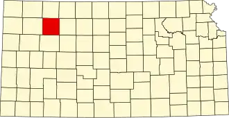 | |
| Unincorporated communities | ||
| Ghost towns | ||
| Townships | ||