Sint-Denijs-Westrem
Sint-Denijs-Westrem | |
|---|---|
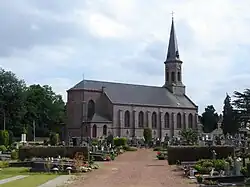 St Denis Church | |
 Coat of arms | |
Location of Sint-Denijs-Westrem | |
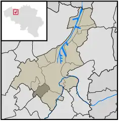 Location of Sint-Denijs-Westrem in Ghent | |
 Sint-Denijs-Westrem 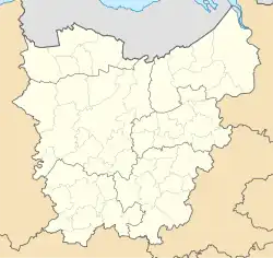 Sint-Denijs-Westrem | |
| Coordinates: 51°01′17″N 3°40′08″E / 51.02139°N 3.66889°E | |
| Country | |
| Community | |
| Region | |
| Province | |
| Arrondissement | Ghent |
| Municipality | Ghent |
| Area | |
• Total | 6.24 km2 (2.41 sq mi) |
| Population (2020-01-01) | |
• Total | 5,545 |
| • Density | 890/km2 (2,300/sq mi) |
| Postal codes | 9051 |
| Area codes | 09 |
Sint-Denijs-Westrem (Dutch: [ˌsɪn dəˈnɛis ˈʋɛstrəm]; French: Saint-Denis-Westrem) is a sub-municipality of the city of Ghent located in the province of East Flanders, Flemish Region, Belgium. It was a separate municipality until 1977. On 1 January 1977, it was merged into Ghent.[1]
History
Sint-Denijs-Westrem lies on the Roman road between Kortrijk and Ghent. Archeological digs on the Flanders Expo site have shown significant signs of settlement from prehistory through the Middle Ages.[2]
During the late Middle Ages the castles of Idewalle, Borluut, Darupt, Hof ten Broecke, Maaltekasteel were built in and around the Sint-Denijs-Westrem area.
In 1858, architect, artisan and designer Jean-Baptiste Bethune moved his studio from Bruges to Sint-Denijs-Westrem.[3]
The town square ("Gemeenteplein") was built between 1895 and 1899.
Until the 20th century the area was mainly agrarian and sparsely populated; from the second half of the 20th century on the village has been steadily more densely built up, with many castle grounds subdivided for housing development.
References
External links
Populated places in Ghent | ||
|---|---|---|
| Sub-municipalities | ||
| Neighbourhoods, villages and hamlets | ||