Horebeke
Horebeke | |
|---|---|
 Church and school of Sint-Kornelis-Horebeke | |
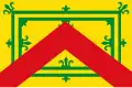 Flag  Coat of arms | |
Location of Horebeke | |
 Horebeke Location in Belgium
Location of Horebeke in East Flanders 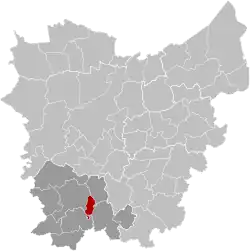 | |
| Coordinates: 50°50′N 03°41′E / 50.833°N 3.683°E | |
| Country | Belgium |
| Community | Flemish Community |
| Region | Flemish Region |
| Province | |
| Arrondissement | Oudenaarde |
| Government | |
| • Mayor | Cynthia Browaeys (Volksbelangen) |
| • Governing party/ies | Volksbelangen |
| Area | |
• Total | 11.25 km2 (4.34 sq mi) |
| Population (2018-01-01)[1] | |
• Total | 2,048 |
| • Density | 180/km2 (470/sq mi) |
| Postal codes | 9667 |
| NIS code | 45062 |
| Area codes | 055 |
| Website | www.horebeke.be |
Horebeke (Dutch pronunciation: [ˈɦoːrəbeːkə]) is a municipality located in the Belgian province of East Flanders. The municipality includes the towns of Sint-Kornelis-Horebeke and Sint-Maria-Horebeke, comprising a total area of 11.20 km2.[2] As of 1 January 2018, Horebeke had a total population of 2,048.
The Corsele parish in Sint-Maria-Horebeke has a Protestant church which dates from 1872 and a museum dedicated to Abraham Hans (the former Protestant village teacher and story teller) built in 1812 as a parish school. There have been Protestants in Sint-Maria-Horebeke since the Reformation of the 16th century.[3]
See also
References
- ^ "Wettelijke Bevolking per gemeente op 1 januari 2018". Statbel. Retrieved 9 March 2019.
- ^ ""Wettelijke Bevolking per gemeente op 1 januari 2018"". StatBel. Retrieved 9 March 2019.
- ^ Regionaal Landschap Vlaamse Ardennen. "Corsele, refuge of the Geuzen". Archived from the original on 19 May 2006. Retrieved 10 April 2008.
External links
 Media related to Horebeke at Wikimedia Commons
Places adjacent to Horebeke | ||||||||||||||||
|---|---|---|---|---|---|---|---|---|---|---|---|---|---|---|---|---|
| ||||||||||||||||
| Aalst | 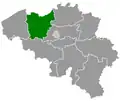 | |
|---|---|---|
| Dendermonde | ||
| Eeklo | ||
| Ghent | ||
| Oudenaarde | ||
| Sint-Niklaas | ||
| ||