Skapce
Skapce | |
|---|---|
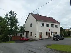 Municipal office | |
 Flag  Coat of arms | |
 Skapce Location in the Czech Republic | |
| Coordinates: 49°39′25″N 12°59′25″E / 49.65694°N 12.99028°E | |
| Country | |
| Region | Plzeň |
| District | Tachov |
| First mentioned | 1115 |
| Area | |
• Total | 7.98 km2 (3.08 sq mi) |
| Elevation | 496 m (1,627 ft) |
| Population (2025-01-01)[1] | |
• Total | 120 |
| • Density | 15/km2 (39/sq mi) |
| Time zone | UTC+1 (CET) |
| • Summer (DST) | UTC+2 (CEST) |
| Postal code | 349 01 |
| Website | www |
Skapce is a municipality and village in Tachov District in the Plzeň Region of the Czech Republic. It has about 100 inhabitants.
Skapce lies approximately 32 kilometres (20 mi) south-east of Tachov, 30 km (19 mi) west of Plzeň, and 114 km (71 mi) south-west of Prague.
Administrative division
Skapce consists of three municipal parts (in brackets population according to the 2021 census):[2]
- Skapce (55)
- Krtín (6)
- Zálezly (56)
Demographics
| Year | Pop. | ±% |
|---|---|---|
| 1869 | 380 | — |
| 1880 | 376 | −1.1% |
| 1890 | 405 | +7.7% |
| 1900 | 444 | +9.6% |
| 1910 | 443 | −0.2% |
| 1921 | 426 | −3.8% |
| 1930 | 446 | +4.7% |
| 1950 | 136 | −69.5% |
| 1961 | 188 | +38.2% |
| 1970 | 146 | −22.3% |
| 1980 | 201 | +37.7% |
| 1991 | 177 | −11.9% |
| 2001 | 117 | −33.9% |
| 2011 | 87 | −25.6% |
| 2021 | 117 | +34.5% |
| Source: Censuses[3][4] | ||
References
- ^ "Population of Municipalities – 1 January 2025". Czech Statistical Office. 2025-05-16.
- ^ "Public Census 2021 – basic data". Public Database (in Czech). Czech Statistical Office. 2022.
- ^ "Historický lexikon obcí České republiky 1869–2011" (in Czech). Czech Statistical Office. 2015-12-21.
- ^ "Population Census 2021: Population by sex". Public Database. Czech Statistical Office. 2021-03-27.
External links
Wikimedia Commons has media related to Skapce.