Tardes (river)
| Tardes | |
|---|---|
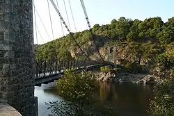 The suspension bridge over the Tardes, between Budelière and Évaux-les-Bains | |
  | |
| Location | |
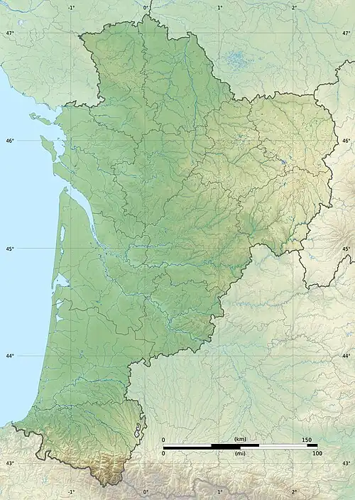
| Country | France |
| Physical characteristics | |
| Source | |
| • location | Basville |
| • coordinates | 45°52′39″N 02°25′06″E / 45.87750°N 2.41833°E |
| • elevation | 720 m (2,360 ft) |
| Mouth | |
• location | Cher |
• coordinates | 46°14′15″N 02°30′48″E / 46.23750°N 2.51333°E |
• elevation | 290 m (950 ft) |
| Length | 77.3 km (48.0 mi) |
| Basin size | 972 km2 (375 sq mi) |
| Discharge | |
| • average | 9.09 m3/s (321 cu ft/s) |
| Basin features | |
| Progression | Cher→ Loire→ Atlantic Ocean |
The Tardes (French pronunciation: [taʁd]; Occitan: Tard) is a 77.3-kilometre-long (48.0 mi) river in the Creuse département, central France.[1] Its source is at Basville. It flows generally north. It is a left tributary of the Cher into which it flows between Évaux-les-Bains and Budelière.
Its main tributary is the Voueize.
Communes along its course
This list is ordered from source to mouth: Basville, Saint-Oradoux-près-Crocq, Crocq, Saint-Pardoux-d'Arnet, La Villetelle, Saint-Avit-de-Tardes, Saint-Silvain-Bellegarde, Lupersat, Champagnat, Saint-Domet, La Serre-Bussière-Vieille, Peyrat-la-Nonière, Saint-Priest, Le Chauchet, Saint-Julien-le-Châtel, Tardes, Lussat, Chambon-sur-Voueize, Évaux-les-Bains, Budelière
References
Wikimedia Commons has media related to Tardes.