Terherne
Terherne | |
|---|---|
Village | |
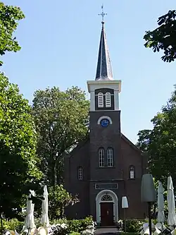 Terherne church | |
 Flag  Coat of arms | |
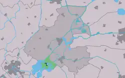 Location in the former Boarnsterhim municipality | |
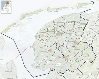 Terherne Location in the Netherlands  Terherne Terherne (Netherlands) | |
| Coordinates: 53°2′25″N 5°46′51″E / 53.04028°N 5.78083°E | |
| Country | |
| Province | |
| Municipality | |
| Area | |
• Total | 9.15 km2 (3.53 sq mi) |
| Elevation | 0.2 m (0.7 ft) |
| Population (2021)[1] | |
• Total | 760 |
| • Density | 83/km2 (220/sq mi) |
| Postal code | 8493 |
| Dialing code | 0566 |
Terherne (Dutch: Terhorne) is a village in De Fryske Marren in the province of Friesland, the Netherlands. It had a population of around 780 in 2017.[3]
History
The village was first mentioned in 1491 as ter Herna, and means "near the corner".[4] In 1840, it was home to 509 people. The Dutch Reformed Church dates from 1874. Terherne has become a recreational village with many holiday homes, and during the holidays the population can increase to around 6,000 people.[5]
Before 2014, Terherne was part of the Boarnsterhim municipality and before 1984 it was part of Utingeradeel.[5]
Transportation
The nearest station is Akkrum railway station.
Gallery
-
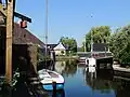 Canal in Terherne
 -
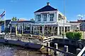 Restaurant De Gouden Liuw
 -
_05.jpg) Bridge at Terherne
Bridge at Terherne -
.jpg) Sunset over the lake
Sunset over the lake
References
- ^ a b "Kerncijfers wijken en buurten 2021". Central Bureau of Statistics. Retrieved 30 March 2022.
- ^ "Postcodetool for 8493KA". Actueel Hoogtebestand Nederland (in Dutch). Het Waterschapshuis. Retrieved 29 March 2022.
- ^ Kerncijfers wijken en buurten 2017 - CBS
- ^ "Terherne - (geografische naam)". Etymologiebank (in Dutch). Retrieved 30 March 2022.
- ^ a b "Terherne". Plaatsengids (in Dutch). Retrieved 30 March 2022.
External links
![]() Media related to Terherne at Wikimedia Commons
Media related to Terherne at Wikimedia Commons