Ternat
Ternat | |
|---|---|
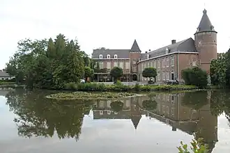 Kruikenburg Castle, Ternat | |
 Flag  Coat of arms | |
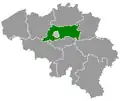
Location of Ternat | |
 Ternat Location in Belgium
Location of Ternat in Flemish Brabant 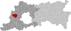 | |
| Coordinates: 50°52′N 04°11′E / 50.867°N 4.183°E | |
| Country | Belgium |
| Community | Flemish Community |
| Region | Flemish Region |
| Province | Flemish Brabant |
| Arrondissement | Halle-Vilvoorde |
| Government | |
| • Mayor | Michel Vanderhasselt (CD&V en Volks) |
| • Governing party/ies | CD&V en Volks, Voor Ternat |
| Area | |
• Total | 24.71 km2 (9.54 sq mi) |
| Population (2018-01-01)[1] | |
• Total | 15,481 |
| • Density | 630/km2 (1,600/sq mi) |
| Postal codes | 1740-1742 |
| NIS code | 23086 |
| Area codes | 02, 053 |
| Website | www.ternat.be |
Ternat (Dutch pronunciation: [tɛrˈnɑt]; also French: Ternath) is a municipality located in the Belgian province of Flemish Brabant. The municipality comprises the villages of Sint-Katherina-Lombeek, Ternat proper and Wambeek. It is also situated in the Pajottenland. On January 1, 2018 Ternat had a total population of 15.481. The total area is 24.48 km2 which gives a population density of 597 inhabitants per km2.
The village of Ternat is the site of a medieval sandstone church and the 12th-century Kruikenburg Castle, extensively remodelled in the 17th century.[2] The local authority offices are housed in an 18th-century mansion.[3]
Notable people
- Everard t'Serclaes (c.1320–1388)
References
- ^ "Wettelijke Bevolking per gemeente op 1 januari 2018". Statbel. Retrieved 9 March 2019.
- ^ Kasteel Kruikenburg, website Toerisme Vlaams Brabant, accessed 23 October 2015.
- ^ Kasteel De Mot, Flemish Heritage Register. Accessed 23 October 2015.
External links
 Media related to Ternat at Wikimedia Commons