Zemst
Zemst | |
|---|---|
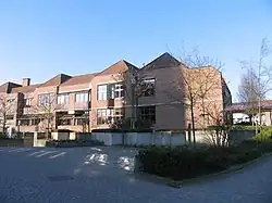 Town hall of Zemst | |
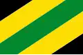 Flag 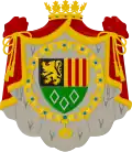 Coat of arms | |
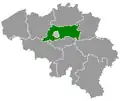
Location of Zemst | |
 Zemst Location in Belgium
Location of Zemst in Flemish Brabant 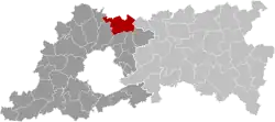 | |
| Coordinates: 50°59′N 04°28′E / 50.983°N 4.467°E | |
| Country | Belgium |
| Community | Flemish Community |
| Region | Flemish Region |
| Province | Flemish Brabant |
| Arrondissement | Halle-Vilvoorde |
| Government | |
| • Mayor | Bart Coopman (Iedereen Zemst) |
| • Governing party/ies | Iedereen Zemst, Team Burgemeester, Vlaams Belang, Groen |
| Area | |
• Total | 43.23 km2 (16.69 sq mi) |
| Population (2018-01-01)[1] | |
• Total | 23,325 |
| • Density | 540/km2 (1,400/sq mi) |
| Postal codes | 1980–1982 |
| NIS code | 23096 |
| Area codes | 015, 02, 016 |
| Website | www.zemst.be |
Zemst (Dutch pronunciation: [zɛmst]) is a municipality located in the Belgian province of Flemish Brabant. The municipality comprises the villages of Elewijt, Eppegem, Hofstade, Weerde, Zemst-Laar, Zemst-Bos and Zemst proper. On January 1, 2024, Zemst had a total population of 23,401. The total area is 42.83 km2 which gives a population density of 541 inhabitants per km2.[2]
References
- ^ "Wettelijke Bevolking per gemeente op 1 januari 2018". Statbel. Retrieved 9 March 2019.
- ^ "Bevolking en huishoudens - Bevolking - Aalst". provincies.incijfers.be. Retrieved 2025-04-18.
External links
 Media related to Zemst at Wikimedia Commons
- Official website – Available only in Dutch
Places adjacent to Zemst | |
|---|---|