Union Township, Delaware County, Indiana
Union Township | |
|---|---|
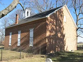 Mount Zion Methodist Church, a historic site in the township | |
 Location of Union Township in Delaware County | |
| Coordinates: 40°20′53″N 85°23′03″W / 40.34806°N 85.38417°W | |
| Country | United States |
| State | Indiana |
| County | Delaware |
| Government | |
| • Type | Indiana township |
| Area | |
• Total | 29.65 sq mi (76.8 km2) |
| • Land | 29.34 sq mi (76.0 km2) |
| • Water | 0.3 sq mi (0.8 km2) |
| Elevation | 899 ft (274 m) |
| Population | |
• Total | 2,540 |
| • Density | 96.7/sq mi (37.3/km2) |
| FIPS code | 18-77246[3] |
| GNIS feature ID | 453913 |
Union Township is one of twelve townships in Delaware County, Indiana. According to the 2010 census, its population was 2,838 and it contained 1,260 housing units.[4]
History
Felt's Farm and the Mount Zion Methodist Episcopal Church are listed on the National Register of Historic Places.[5]
Geography
According to the 2010 census, the township has a total area of 29.65 square miles (76.8 km2), of which 29.34 square miles (76.0 km2) (or 98.95%) is land and 0.3 square miles (0.78 km2) (or 1.01%) is water.[4]
Cities and towns
Unincorporated towns
(This list is based on USGS data and may include former settlements.)
Adjacent townships
- Licking Township, Blackford County (north)
- Jackson Township, Blackford County (northeast)
- Niles Township (east)
- Delaware Township (southeast)
- Hamilton Township (south)
- Harrison Township (southwest)
- Washington Township (west)
Major highways
Cemeteries
The township contains three cemeteries: Leaird, Mount Zion Church and Union.
Education
It is in the Delaware Community School Corporation.[6]
References
- ^ "US Board on Geographic Names". United States Geological Survey. October 25, 2007. Retrieved January 31, 2008.
- ^ "Census Bureau profile: Union Township, Delaware County, Indiana". United States Census Bureau. May 2023. Retrieved March 18, 2024.
- ^ "U.S. Census website". United States Census Bureau. Retrieved January 31, 2008.
- ^ a b "Population, Housing Units, Area, and Density: 2010 - State -- County Subdivision -- 2010 Census Summary File 1". United States Census. Archived from the original on February 12, 2020. Retrieved May 10, 2013.
- ^ "National Register Information System". National Register of Historic Places. National Park Service. July 9, 2010.
- ^ Geography Division (January 12, 2021). 2020 CENSUS - SCHOOL DISTRICT REFERENCE MAP: Delaware County, IN (PDF) (Map). U.S. Census Bureau. Retrieved June 3, 2025. - Text list
External links
Wikimedia Commons has media related to Union Township, Delaware County, Indiana.
Municipalities and communities of Delaware County, Indiana, United States | ||
|---|---|---|
| City |  | |
| Towns | ||
| Townships | ||
| CDPs | ||
| Other communities | ||
| Footnotes | ‡This populated place also has portions in an adjacent county or counties | |