Wittring
Wittring | |
|---|---|
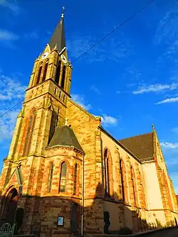 The church in Wittring | |
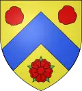 Coat of arms | |
Location of Wittring | |
 Wittring  Wittring | |
| Coordinates: 49°03′19″N 7°08′48″E / 49.0553°N 7.1467°E | |
| Country | France |
| Region | Grand Est |
| Department | Moselle |
| Arrondissement | Sarreguemines |
| Canton | Sarreguemines |
| Intercommunality | CA Sarreguemines Confluences |
| Government | |
| • Mayor (2023–2026) | Bernard Rohr[1] |
Area 1 | 8.09 km2 (3.12 sq mi) |
| Population (2022)[2] | 741 |
| • Density | 92/km2 (240/sq mi) |
| Time zone | UTC+01:00 (CET) |
| • Summer (DST) | UTC+02:00 (CEST) |
| INSEE/Postal code | 57748 /57905 |
| Elevation | 199–336 m (653–1,102 ft) |
| 1 French Land Register data, which excludes lakes, ponds, glaciers > 1 km2 (0.386 sq mi or 247 acres) and river estuaries. | |
Wittring (French pronunciation: [vitʁɛ̃]; Lorraine Franconian: Wittringe) is a commune in the Moselle department in Grand Est in north-eastern France.
Population
| Year | Pop. | ±% p.a. |
|---|---|---|
| 1968 | 874 | — |
| 1975 | 907 | +0.53% |
| 1982 | 844 | −1.02% |
| 1990 | 840 | −0.06% |
| 1999 | 821 | −0.25% |
| 2007 | 826 | +0.08% |
| 2012 | 818 | −0.19% |
| 2017 | 790 | −0.69% |
| Source: INSEE[3] | ||
See also
References
- ^ "Répertoire national des élus: les maires" (in French). data.gouv.fr, Plateforme ouverte des données publiques françaises. 30 November 2023.
- ^ "Populations de référence 2022" (in French). The National Institute of Statistics and Economic Studies. 19 December 2024.
- ^ Population en historique depuis 1968, INSEE
External links
 Media related to Wittring at Wikimedia Commons