Bétheniville
Bétheniville | |
|---|---|
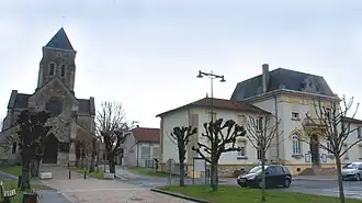 The church and town hall in Bétheniville | |
.svg.png) Coat of arms | |
Location of Bétheniville | |
 Bétheniville  Bétheniville | |
| Coordinates: 49°17′38″N 4°22′05″E / 49.2939°N 4.3681°E | |
| Country | France |
| Region | Grand Est |
| Department | Marne |
| Arrondissement | Reims |
| Canton | Mourmelon-Vesle et Monts de Champagne |
| Intercommunality | CU Grand Reims |
| Government | |
| • Mayor (2020–2026) | Jean-Jacques Gouault[1] |
Area 1 | 17.74 km2 (6.85 sq mi) |
| Population (2022)[2] | 1,270 |
| • Density | 72/km2 (190/sq mi) |
| Time zone | UTC+01:00 (CET) |
| • Summer (DST) | UTC+02:00 (CEST) |
| INSEE/Postal code | 51054 /51490 |
| Elevation | 100 m (330 ft) |
| 1 French Land Register data, which excludes lakes, ponds, glaciers > 1 km2 (0.386 sq mi or 247 acres) and river estuaries. | |
Bétheniville (French pronunciation: [betnivil]) is a commune in the Marne department in northeastern France.
Geography
The commune is traversed by the Suippe river.
Population
| Year | Pop. | ±% p.a. |
|---|---|---|
| 1968 | 773 | — |
| 1975 | 727 | −0.87% |
| 1982 | 803 | +1.43% |
| 1990 | 843 | +0.61% |
| 1999 | 851 | +0.11% |
| 2009 | 1,125 | +2.83% |
| 2014 | 1,283 | +2.66% |
| 2020 | 1,290 | +0.09% |
| Source: INSEE[3] | ||
See also
References
- ^ "Répertoire national des élus: les maires". data.gouv.fr, Plateforme ouverte des données publiques françaises (in French). 2 December 2020.
- ^ "Populations de référence 2022" (in French). The National Institute of Statistics and Economic Studies. 19 December 2024.
- ^ Population en historique depuis 1968, INSEE
Wikimedia Commons has media related to Bétheniville.