Boleboř
Boleboř | |
|---|---|
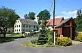
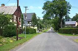 Main street | |
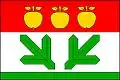 Flag 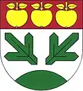 Coat of arms | |
 Boleboř Location in the Czech Republic | |
| Coordinates: 50°32′25″N 13°24′48″E / 50.54028°N 13.41333°E | |
| Country | |
| Region | Ústí nad Labem |
| District | Chomutov |
| First mentioned | 1352 |
| Area | |
• Total | 20.08 km2 (7.75 sq mi) |
| Elevation | 620 m (2,030 ft) |
| Population (2025-01-01)[1] | |
• Total | 351 |
| • Density | 17/km2 (45/sq mi) |
| Time zone | UTC+1 (CET) |
| • Summer (DST) | UTC+2 (CEST) |
| Postal code | 431 21 |
| Website | www |
Boleboř (German: Göttersdorf) is a municipality and village in Chomutov District in the Ústí nad Labem Region of the Czech Republic. It has about 400 inhabitants.
Boleboř lies approximately 8 kilometres (5 mi) north of Chomutov, 47 km (29 mi) west of Ústí nad Labem, and 88 km (55 mi) north-west of Prague.
Administrative division
Boleboř consists of three municipal parts (in brackets population according to the 2021 census):[2]
- Boleboř (206)
- Orasín (81)
- Svahová (23)
Demographics
| Year | Pop. | ±% |
|---|---|---|
| 1869 | 941 | — |
| 1880 | 885 | −6.0% |
| 1890 | 847 | −4.3% |
| 1900 | 826 | −2.5% |
| 1910 | 788 | −4.6% |
| 1921 | 785 | −0.4% |
| 1930 | 788 | +0.4% |
| 1950 | 239 | −69.7% |
| 1961 | 233 | −2.5% |
| 1970 | 277 | +18.9% |
| 1980 | 222 | −19.9% |
| 1991 | 171 | −23.0% |
| 2001 | 194 | +13.5% |
| 2011 | 224 | +15.5% |
| 2021 | 310 | +38.4% |
| Source: Censuses[3][4] | ||
Gallery
-
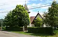 Church of Saint Nicholas
 -
 The village of Orasín
References
- ^ "Population of Municipalities – 1 January 2025". Czech Statistical Office. 2025-05-16.
- ^ "Public Census 2021 – basic data". Public Database (in Czech). Czech Statistical Office. 2022.
- ^ "Historický lexikon obcí České republiky 1869–2011" (in Czech). Czech Statistical Office. 2015-12-21.
- ^ "Population Census 2021: Population by sex". Public Database. Czech Statistical Office. 2021-03-27.
External links
Wikimedia Commons has media related to Boleboř.