Château-Arnoux-Saint-Auban
Château-Arnoux-Saint-Auban
Castèl-Arnós e Sant Auban (Occitan) | |
|---|---|
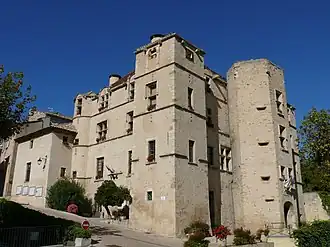 Chateau | |
 Coat of arms | |
Location of Château-Arnoux-Saint-Auban | |
 Château-Arnoux-Saint-Auban 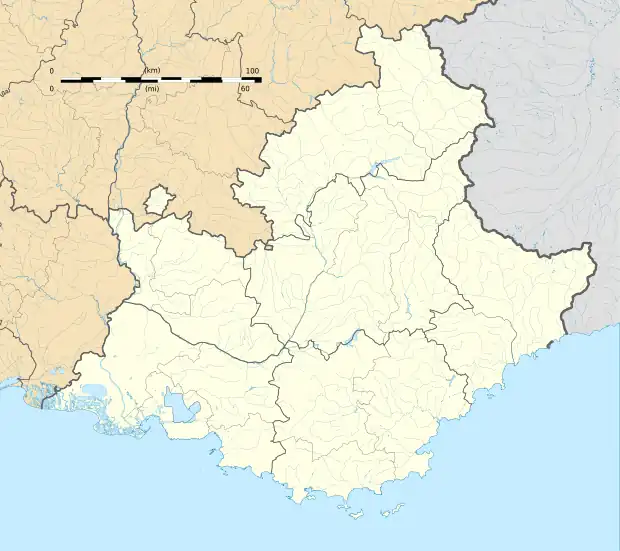 Château-Arnoux-Saint-Auban | |
| Coordinates: 44°05′39″N 6°00′33″E / 44.0942°N 6.0092°E | |
| Country | France |
| Region | Provence-Alpes-Côte d'Azur |
| Department | Alpes-de-Haute-Provence |
| Arrondissement | Digne-les-Bains |
| Canton | Château-Arnoux-Saint-Auban |
| Intercommunality | CA Provence-Alpes |
| Government | |
| • Mayor (2020–2026) | René Villard[1] |
Area 1 | 18.34 km2 (7.08 sq mi) |
| Population (2022)[2] | 5,095 |
| • Density | 280/km2 (720/sq mi) |
| Time zone | UTC+01:00 (CET) |
| • Summer (DST) | UTC+02:00 (CEST) |
| INSEE/Postal code | 04049 /04160 |
| Elevation | 403–742 m (1,322–2,434 ft) (avg. 440 m or 1,440 ft) |
| 1 French Land Register data, which excludes lakes, ponds, glaciers > 1 km2 (0.386 sq mi or 247 acres) and river estuaries. | |
Château-Arnoux-Saint-Auban (French: [ʃɑto aʁnu sɛ̃t‿obɑ̃]; Occitan: Castèl-Arnós e Sant Auban, before 1991: Château-Arnoux)[3] is a commune in the department of Alpes-de-Haute-Provence in the region of Provence-Alpes-Côte d'Azur in southeastern France.
History
Château-Arnoux-Saint-Auban is on the Route Napoléon, the route taken by Napoléon in 1815 on his return from Elba.
Geography
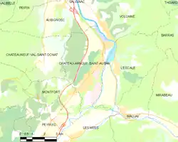
Château-Arnoux-Saint-Auban is on the river Durance.
| Climate data for Château-Arnoux-Saint-Auban (1991–2020 normals) | |||||||||||||
|---|---|---|---|---|---|---|---|---|---|---|---|---|---|
| Month | Jan | Feb | Mar | Apr | May | Jun | Jul | Aug | Sep | Oct | Nov | Dec | Year |
| Mean daily maximum °C (°F) | 9.5 (49.1) |
11.2 (52.2) |
15.3 (59.5) |
18.1 (64.6) |
22.3 (72.1) |
26.9 (80.4) |
30.3 (86.5) |
30.0 (86.0) |
24.7 (76.5) |
19.4 (66.9) |
13.3 (55.9) |
9.5 (49.1) |
19.2 (66.6) |
| Mean daily minimum °C (°F) | 0.2 (32.4) |
0.3 (32.5) |
3.1 (37.6) |
5.8 (42.4) |
9.7 (49.5) |
13.4 (56.1) |
15.8 (60.4) |
15.7 (60.3) |
12.1 (53.8) |
8.6 (47.5) |
4.1 (39.4) |
0.9 (33.6) |
7.5 (45.5) |
| Average precipitation mm (inches) | 48 (1.9) |
36 (1.4) |
45 (1.8) |
65 (2.6) |
64 (2.5) |
54 (2.1) |
36 (1.4) |
51 (2.0) |
74 (2.9) |
88 (3.5) |
96 (3.8) |
56 (2.2) |
714 (28.1) |
| Mean monthly sunshine hours | 168 | 183 | 230 | 228 | 263 | 303 | 342 | 312 | 249 | 196 | 157 | 149 | 2,779 |
| Source: Meteo-Express[4] | |||||||||||||
Population
Its inhabitants are referred to as Jarlandins.
| Year | Pop. | ±% p.a. |
|---|---|---|
| 1968 | 6,532 | — |
| 1975 | 6,240 | −0.65% |
| 1982 | 5,576 | −1.59% |
| 1990 | 5,109 | −1.09% |
| 1999 | 4,970 | −0.31% |
| 2007 | 5,148 | +0.44% |
| 2012 | 5,184 | +0.14% |
| 2017 | 5,139 | −0.17% |
| Source: INSEE[5] | ||
Sights
Château-Arnoux-Saint-Auban has one of the French pacifist monuments to the dead, which reads: "war is a crime".
The airfield is "Le Centre National de Vol à Voile", the French national centre for the sport of gliding.
Education
A campus of the École nationale de l'aviation civile is located in the commune.[6][7]
See also
References
- ^ "Répertoire national des élus: les maires" (in French). data.gouv.fr, Plateforme ouverte des données publiques françaises. 13 September 2022.
- ^ "Populations de référence 2022" (in French). The National Institute of Statistics and Economic Studies. 19 December 2024.
- ^ Décret du 13 décembre 1991 portant changement de nom de communes, Légifrance.
- ^ "Le climat de Château-Arnoux-Saint-Auban (04)" (in Dutch). Meteo-Express. Retrieved 12 August 2025.
- ^ Population en historique depuis 1968, INSEE
- ^ (in French) Enac / SEFA : La fusion opérationnelle pour le 1er janvier 2011
- ^ (in French) Vie des campus Archived 2012-03-07 at the Wayback Machine