Oraison
Oraison
Aureson (Occitan) | |
|---|---|
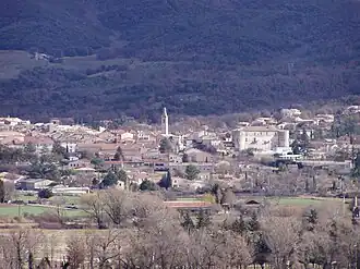 A general view of the village of Oraison | |
 Coat of arms | |
Location of Oraison | |
 Oraison 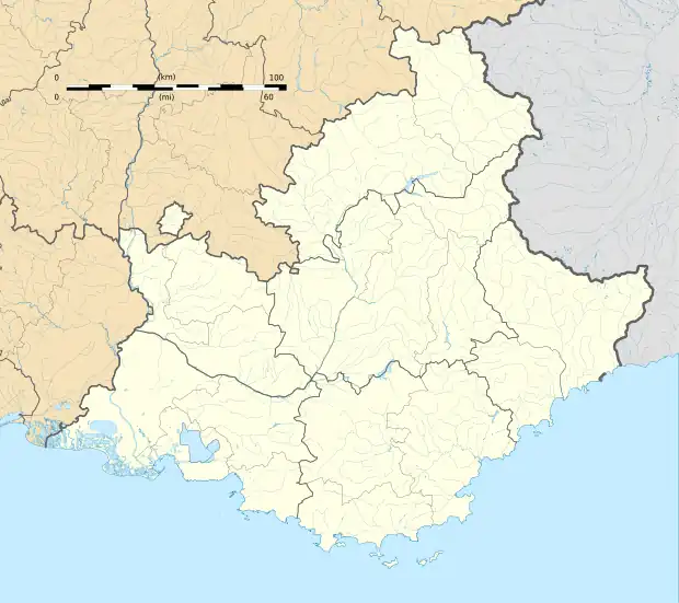 Oraison | |
| Coordinates: 43°55′05″N 5°55′09″E / 43.9181°N 5.9192°E | |
| Country | France |
| Region | Provence-Alpes-Côte d'Azur |
| Department | Alpes-de-Haute-Provence |
| Arrondissement | Forcalquier |
| Canton | Oraison |
| Intercommunality | Durance-Luberon-Verdon Agglomération |
| Government | |
| • Mayor (2020–2026) | Benoît Gauvan[1] (LREM) |
Area 1 | 38.42 km2 (14.83 sq mi) |
| Population (2022)[2] | 6,042 |
| • Density | 160/km2 (410/sq mi) |
| Demonym | Oraisonnais |
| Time zone | UTC+01:00 (CET) |
| • Summer (DST) | UTC+02:00 (CEST) |
| INSEE/Postal code | 04143 /04700 |
| Elevation | 323–645 m (1,060–2,116 ft) (avg. 373 m or 1,224 ft) |
| Website | oraison |
| 1 French Land Register data, which excludes lakes, ponds, glaciers > 1 km2 (0.386 sq mi or 247 acres) and river estuaries. | |
Oraison (French pronunciation: [ɔʁɛzɔ̃] ⓘ; Occitan: Aureson) is a commune in the Alpes-de-Haute-Provence department in Southeastern France.
Geography
The river Asse forms all of the commune's southern border, then flows into the Durance, which forms all of its western border.
Population
|
| |||||||||||||||||||||||||||||||||||||||||||||||||||||||||||||||||||||||||||||||||||||||||||||||||||||||||||||||
| Source: EHESS[3] and INSEE (1968-2017)[4] | ||||||||||||||||||||||||||||||||||||||||||||||||||||||||||||||||||||||||||||||||||||||||||||||||||||||||||||||||
See also
References
- ^ "Répertoire national des élus: les maires" (in French). data.gouv.fr, Plateforme ouverte des données publiques françaises. 6 June 2023.
- ^ "Populations de référence 2022" (in French). The National Institute of Statistics and Economic Studies. 19 December 2024.
- ^ Des villages de Cassini aux communes d'aujourd'hui: Commune data sheet Oraison, EHESS (in French).
- ^ Population en historique depuis 1968, INSEE
Wikimedia Commons has media related to Oraison.