Dehri
Dehri
Dehri-On-Sone | |
|---|---|
Urban Area | |
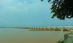
Indrapuri Barrage at Dehri On Sone, Dehri Junction | |
 | |
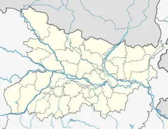 Dehri Location in Bihar, India  Dehri Dehri (India) | |
| Coordinates: 24°55′N 84°11′E / 24.91°N 84.18°E | |
| Country | |
| State | Bihar |
| District | Rohtas |
| Government | |
| • Type | Municipality |
| • Body | Dehri Urban Development Authority (DUDA) |
| Elevation | 52 m (171 ft) |
| Population (2011) | |
• Total | 137,231 |
| Languages | |
| • Official | Hindi |
| • Others | Bhojpuri |
| Time zone | UTC+5:30 (IST) |
| PIN | 821305,821307[1] |
| Vehicle registration | BR-24 |
| Railway Station | Dehri-on-Sone Junction |
| Website | rohtas |

Dehri (also spelled as Dehree[2]) also known as Dehri-on-Sone is a Nagar parishad and corresponding community development block in Rohtas district in the state of Bihar, India. Situated on the banks of Sone River,[3] Dehri is a railway hub, and is adjoining Dalmianagar that used to be an industrial town.
Etymology
The name Dehri-on-Sone is based on the Sone River. The city is situated at the banks of the Sone River.[4]
Demographics
| Year | Pop. | ±% |
|---|---|---|
| 1941 | 8,281 | — |
| 1951 | 24,406 | +194.7% |
| 1961 | 38,092 | +56.1% |
| 1971 | 46,037 | +20.9% |
| 1981 | 90,409 | +96.4% |
| 1991 | 93,594 | +3.5% |
| 2001 | 119,057 | +27.2% |
| 2011 | 137,231 | +15.3% |
| Source: 2011 Census of India[5] | ||
As of 2011, its population was 137,231, in 23,234 households.[5] Dehri is home to the Indrapuri Barrage, the fourth-longest barrage in the world.[6]
Males were 72,372 and females 64,859. The average literacy rate was 81.2%, higher than the national average of 74%. Male literacy was 87.54% and female literacy 74.08%. The population of children in age group 0–6 years was 19,010, of which boys were 9,886 and girls 9,124.
Economy
Important industries in Dehri include sawmilling and ghee processing.[3] Other important commodities include plastic pipes, light bulbs, and shoes.[5]
The headworks of the Sone canal system is located in Dehri.[3][5]
Recreation
Dehri is home to a stadium, five cinemas, four auditoriums, and three public libraries.[5]
Transportation
Dehri-on-Sone railway station (station code: DOS) is on the Gaya–Pandit Deen Dayal Upadhyaya Junction section of the Grand Chord line. It is the major railway station of Dehri. [7]
Dehri is located on major road Delhi Kolkata Highway, which connects to the major cities of India.
Climate
| Climate data for Dehri (1991–2020, extremes 1901–2020) | |||||||||||||
|---|---|---|---|---|---|---|---|---|---|---|---|---|---|
| Month | Jan | Feb | Mar | Apr | May | Jun | Jul | Aug | Sep | Oct | Nov | Dec | Year |
| Record high °C (°F) | 31.0 (87.8) |
36.0 (96.8) |
41.5 (106.7) |
45.3 (113.5) |
49.5 (121.1) |
47.2 (117.0) |
44.5 (112.1) |
39.4 (102.9) |
37.1 (98.8) |
39.7 (103.5) |
35.1 (95.2) |
31.7 (89.1) |
49.5 (121.1) |
| Mean daily maximum °C (°F) | 22.4 (72.3) |
26.4 (79.5) |
33.0 (91.4) |
38.9 (102.0) |
40.5 (104.9) |
38.0 (100.4) |
33.6 (92.5) |
32.8 (91.0) |
32.4 (90.3) |
31.5 (88.7) |
28.9 (84.0) |
24.6 (76.3) |
32.1 (89.8) |
| Mean daily minimum °C (°F) | 8.5 (47.3) |
11.4 (52.5) |
15.6 (60.1) |
21.3 (70.3) |
23.8 (74.8) |
24.7 (76.5) |
24.9 (76.8) |
24.7 (76.5) |
23.9 (75.0) |
20.3 (68.5) |
13.5 (56.3) |
9.7 (49.5) |
18.6 (65.5) |
| Record low °C (°F) | −1.0 (30.2) |
0.0 (32.0) |
1.5 (34.7) |
3.0 (37.4) |
5.0 (41.0) |
13.5 (56.3) |
11.4 (52.5) |
11.0 (51.8) |
10.8 (51.4) |
4.0 (39.2) |
0.0 (32.0) |
0.0 (32.0) |
−1.0 (30.2) |
| Average rainfall mm (inches) | 11.1 (0.44) |
17.4 (0.69) |
9.6 (0.38) |
10.2 (0.40) |
35.4 (1.39) |
132.9 (5.23) |
316.2 (12.45) |
297.8 (11.72) |
190.4 (7.50) |
43.7 (1.72) |
1.7 (0.07) |
3.5 (0.14) |
1,070.1 (42.13) |
| Average rainy days | 1.0 | 1.4 | 1.1 | 1.0 | 2.5 | 6.7 | 13.4 | 13.2 | 9.0 | 2.2 | 0.2 | 0.4 | 52.1 |
| Average relative humidity (%) (at 17:30 IST) | 66 | 60 | 44 | 32 | 37 | 56 | 74 | 79 | 81 | 74 | 65 | 64 | 61 |
| Source: India Meteorological Department[8][9][10] | |||||||||||||
Villages
The CD block of Dehri contains 58 rural villages, all of which are inhabited:[5]
| Village name | Total land area (hectares) | Population (in 2011) |
|---|---|---|
| Panruhar | 557 | 1,803 |
| Gohi | 123 | 1,353 |
| Gonuwan | 69 | 720 |
| Maudiha | 136 | 1,727 |
| Shiwpur | 78 | 590 |
| Barawan | 279 | 4,521 |
| Ahirawan | 176 | 1,942 |
| Khudrawan | 120 | 1,439 |
| Chilbila | 97 | 1,380 |
| Parsawan | 55 | 1,307 |
| Tanrwa | 210 | 1,177 |
| Majhiawan | 195 | 1,839 |
| Ayar Kotha | 53 | 1,138 |
| Darihat | 1,123 | 11,953 |
| Bhusahula | 291 | 2,953 |
| Chainpur | 311 | 876 |
| Berkap | 454 | 2,893 |
| Bharkunria | 184 | 1,885 |
| Ahibaranpur | 121 | 2,065 |
| Hurka | 320 | 1,982 |
| Sidhauli | 22 | 2,320 |
| Gangauli | 447 | 5,279 |
| Pahleza | 338 | 6,464 |
| Shiupur | 59 | 932 |
| Deuria | 284 | 2,939 |
| Tendua Dusadhi | 239 | 2,660 |
| Mahdewa | 175 | 1,298 |
| Chormara | 74 | 25 |
| Jamuhar | 368 | 6,228 |
| Rudarpura | 210 | 1,121 |
| Chakia | 264 | 2,362 |
| Manaura | 70 | 625 |
| Mathuri | 180 | 3,581 |
| Sakhara | 405 | 5,820 |
| Suara | 267 | 2,584 |
| Dahaur | 276 | 2,802 |
| Patpura | 219 | 1,617 |
| Bharkunria | 320 | 1,737 |
| Guraila | 146 | 1,933 |
| Durgapur | 170 | 1,461 |
| Bhatauli | 162 | 1,558 |
| Wojhaulia | 19 | 731 |
| Ghonghaha | 96 | 1,865 |
| Khairaha | 135 | 1,853 |
| Bhainsaha | 64 | 2,833 |
| Bastipur | 451 | 2,159 |
| Katar | 853 | 3,368 |
| Bardiha | 94 | 1,477 |
| Sujanpur | 109 | 1,750 |
| Manikpur | 53 | 1,814 |
| Bhaluari | 475 | 6,821 |
| Nawadih | 422 | 4,000 |
| Dudhmi | 134 | 1,705 |
| Shahpur | 103 | 89 |
| Chaknaha | 155 | 1,831 |
| Shankarpur | 120 | 2,056 |
| Sikaria | 619 | 559 |
| Patanawa | 528 | 1,983 |
| Garwat Bigha | 60 | 805 |
References
- ^ Dehri on Sone Rohtas Pin Code, citypincode.in
- ^ Thornton, J. H. (1 June 1874). "Report on Cholera in the Shahabad District". The Indian Medical Gazette. 9 (6): 146–147. ISSN 0019-5863. PMC 5128170. PMID 28995022.
- ^ a b c "Dehri". Encyclopaedia Britannica. Retrieved 21 May 2020.
- ^ "डेहरी ऑन सोन में स्तिथ है भारत की 5वीं सबसे लम्बी रेल ब्रिज". dehrionsonecity.com. 12 April 2021. Retrieved 13 June 2021.
- ^ a b c d e f "Census of India 2011: Bihar District Census Handbook - Rohtas, Part A (Village and Town Directory)". Census 2011 India. pp. 33, 44–70, 1084–1123, 1191–1192, 1286–1299. Retrieved 20 May 2020.
- ^ "Indrapuri Dam". Rohtas District. Retrieved 21 May 2020.
- ^ https://indiarailinfo.com/arrivals/dehri-on-sone-dos/1390
- ^ "Climatological Tables of Observatories in India 1991-2020" (PDF). India Meteorological Department. Retrieved 8 April 2024.
- ^ "Station: Dehri Climatological Table 1981–2010" (PDF). Climatological Normals 1981–2010. India Meteorological Department. January 2015. pp. 235–236. Archived from the original (PDF) on 5 February 2020. Retrieved 18 August 2020.
- ^ "Extremes of Temperature & Rainfall for Indian Stations (Up to 2012)" (PDF). India Meteorological Department. December 2016. p. M33. Archived from the original (PDF) on 5 February 2020. Retrieved 18 August 2020.