Éblange
Éblange | |
|---|---|
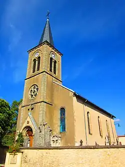 St. Wendelin's Church | |
.svg.png) Coat of arms | |
Location of Éblange | |
 Éblange  Éblange | |
| Coordinates: 49°13′27″N 6°28′58″E / 49.2242°N 6.4828°E | |
| Country | France |
| Region | Grand Est |
| Department | Moselle |
| Arrondissement | Forbach-Boulay-Moselle |
| Canton | Boulay-Moselle |
| Intercommunality | Houve-Pays Boulageois |
| Government | |
| • Mayor (2020–2026) | Edouard Hombourger[1] |
Area 1 | 3.32 km2 (1.28 sq mi) |
| Population (2022)[2] | 363 |
| • Density | 110/km2 (280/sq mi) |
| Time zone | UTC+01:00 (CET) |
| • Summer (DST) | UTC+02:00 (CEST) |
| INSEE/Postal code | 57187 /57220 |
| Elevation | 198–295 m (650–968 ft) (avg. 202 m or 663 ft) |
| 1 French Land Register data, which excludes lakes, ponds, glaciers > 1 km2 (0.386 sq mi or 247 acres) and river estuaries. | |
Éblange (French pronunciation: [eblɑ̃ʒ]; German: Eblingen) is a commune in the Moselle department in Grand Est in north-eastern France.[3]
Population
| Year | Pop. | ±% p.a. |
|---|---|---|
| 1968 | 143 | — |
| 1975 | 122 | −2.24% |
| 1982 | 217 | +8.57% |
| 1990 | 251 | +1.84% |
| 1999 | 246 | −0.22% |
| 2007 | 280 | +1.63% |
| 2012 | 386 | +6.63% |
| 2017 | 374 | −0.63% |
| Source: INSEE[4] | ||
See also
References
- ^ "Répertoire national des élus: les maires" (in French). data.gouv.fr, Plateforme ouverte des données publiques françaises. 13 September 2022.
- ^ "Populations de référence 2022" (in French). The National Institute of Statistics and Economic Studies. 19 December 2024.
- ^ "Eblange". www.paysboulageois.fr (in French). Retrieved 19 August 2018.
- ^ Population en historique depuis 1968, INSEE
External links
 Media related to Éblange at Wikimedia Commons