Emma, Kentucky
Emma, Kentucky | |
|---|---|
 Emma Location within the state of Kentucky  Emma Emma (the United States) | |
| Coordinates: 37°38′7″N 82°42′1″W / 37.63528°N 82.70028°W | |
| Country | United States |
| State | Kentucky |
| County | Floyd |
| Elevation | 640 ft (200 m) |
| Time zone | UTC-5 (Eastern (EST)) |
| • Summer (DST) | UTC-4 (EST) |
| ZIP codes | 41625 |
| GNIS feature ID | 491764[1] |
Emma is an unincorporated community and coal town in Floyd County, Kentucky, United States.
A post office was established in the community in 1908. The origins of place name Emma are unclear: some hold it was named for the wife of the congressman John W. Langley, while others believe it was named for the wife of a prominent realtor.[2]
References
- ^ U.S. Geological Survey Geographic Names Information System: Emma, Kentucky
- ^ Rennick, Robert M. (1987). Kentucky Place Names. University Press of Kentucky. p. 93. ISBN 0813126312. Retrieved April 28, 2013.
Municipalities and communities of Floyd County, Kentucky, United States | ||
|---|---|---|
| Cities | 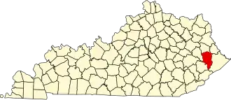 | |
| CDPs | ||
| Other unincorporated communities |
| |
| Footnotes | ‡This populated place also has portions in an adjacent county or counties. | |