Franklin, Maryland
Franklin, Maryland | |
|---|---|
_just_south_of_Maryland_State_Route_36_(New_Georges_Creek_Road)_in_Franklin%252C_Allegany_County%252C_Maryland.jpg) | |
 Franklin | |
| Coordinates: 39°30′01″N 79°03′03″W / 39.50028°N 79.05083°W | |
| Country | United States |
| State | Maryland |
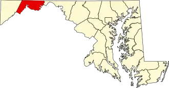
| County | Allegany |
| Area | |
• Total | 0.28 sq mi (0.71 km2) |
| • Land | 0.28 sq mi (0.71 km2) |
| • Water | 0.00 sq mi (0.00 km2) |
| Elevation | 1,106 ft (337 m) |
| Population (2020) | |
• Total | 253 |
| • Density | 916.67/sq mi (354.04/km2) |
| Time zone | UTC-5 (Eastern (EST)) |
| • Summer (DST) | UTC-4 (EDT) |
| ZIP code | 21562[3] |
| Area codes | 301, 240 |
| GNIS feature ID | 2583624[2] |
Franklin is an unincorporated community and census-designated place (CDP) in Allegany County, Maryland, United States. As of the 2010 census it had a population of 290.[4]
Franklin is located along Maryland routes 36 and 937, 1 mile (1.6 km) north of Westernport.[5]
Demographics
| Census | Pop. | Note | %± |
|---|---|---|---|
| 2020 | 253 | — | |
| U.S. Decennial Census[6] | |||
References
- ^ "2020 U.S. Gazetteer Files". United States Census Bureau. Retrieved April 26, 2022.
- ^ a b U.S. Geological Survey Geographic Names Information System: Franklin, Maryland
- ^ "Franklin MD ZIP Code". zipdatamaps.com. 2023. Retrieved April 18, 2023.
- ^ "Geographic Identifiers: 2010 Demographic Profile Data (G001): Franklin CDP, Maryland". U.S. Census Bureau, American Factfinder. Archived from the original on February 12, 2020. Retrieved May 24, 2013.
- ^ Westernport MD_WV 7.5 Minute Topographic Quadrangle, USGS, 1996
- ^ "Census of Population and Housing". Census.gov. Retrieved June 4, 2016.
Wikimedia Commons has media related to Franklin, Maryland.