Gaby, Aosta Valley
Gaby | |
|---|---|
| Comune di Gaby Commune de Gaby | |
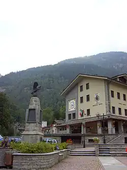 The town hall and the school. | |
.svg.png) Coat of arms | |
Location of Gaby | |
 Gaby Location of Gaby in Italy 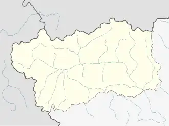 Gaby Gaby (Aosta Valley) | |
| Coordinates: 45°42′16″N 7°53′2″E / 45.70444°N 7.88389°E | |
| Country | Italy |
| Region | Aosta Valley |
| Province | none |
| Frazioni | Bouri, Chanton Desor, Chanton Desout, Chef-lieu, Crusmato, Gattinéry, Gruba, Niel, Pont-de-Trentaz, Rubin, Serta Desor, Serta Desout, Tzendelabò, Pro du Toucco, Yair Desout, Moulin, Palatz, Halberpein, Voury, Yair Desor, Zappegly, Zuino |
| Government | |
| • Mayor | Pierluigi Ropele |
| Area | |
• Total | 32.46 km2 (12.53 sq mi) |
| Elevation | 1,047 m (3,435 ft) |
| Population (31 December 2022)[2] | |
• Total | 423 |
| • Density | 13/km2 (34/sq mi) |
| Demonym | Gabençois |
| Time zone | UTC+1 (CET) |
| • Summer (DST) | UTC+2 (CEST) |
| Postal code | 11020 |
| Dialing code | 0125 |
| Patron saint | Archangel Michael |
| Saint day | 29 September |
| Website | Official website |
Gaby ⓘ (Walser: Goobi; Issime Walser: Überlann, lit. 'Upper Land'; Valdôtain: Gabi) is a town and comune in the Aosta Valley region of northwestern Italy.
Landmarks
- Sanctuary of Voury
See also
 Media related to Gaby at Wikimedia Commons
- ^ "Superficie di Comuni Province e Regioni italiane al 9 ottobre 2011". Italian National Institute of Statistics. Retrieved 16 March 2019.
- ^ "Popolazione Residente al 1° Gennaio 2018". Italian National Institute of Statistics. Retrieved 16 March 2019.