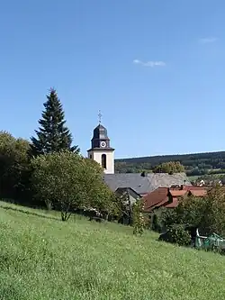
Greimerath, Trier-Saarburg
Greimerath | |
|---|---|
_COA.svg.png) Coat of arms | |
Location of Greimerath within Trier-Saarburg district 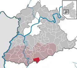 | |
 Greimerath 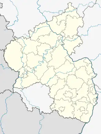 Greimerath | |
| Coordinates: 49°33′42.58″N 6°41′0.7″E / 49.5618278°N 6.683528°E | |
| Country | Germany |
| State | Rhineland-Palatinate |
| District | Trier-Saarburg |
| Municipal assoc. | Saarburg-Kell |
| Government | |
| • Mayor (2019–24) | Edmund Schmitt[1] |
| Area | |
• Total | 12.12 km2 (4.68 sq mi) |
| Elevation | 430 m (1,410 ft) |
| Population (2023-12-31)[2] | |
• Total | 941 |
| • Density | 78/km2 (200/sq mi) |
| Time zone | UTC+01:00 (CET) |
| • Summer (DST) | UTC+02:00 (CEST) |
| Postal codes | 54314 |
| Dialling codes | 06587 |
| Vehicle registration | TR |
| Website | Gemeinde Greimerath |
Greimerath is a municipality in the Trier-Saarburg district, in Rhineland-Palatinate, Germany.
History
From 18 July 1946 to 6 June 1947 Greimerath, in its then municipal boundary, formed part of the Saar Protectorate.
References
- ^ Direktwahlen 2019, Landkreis Trier-Saarburg, Landeswahlleiter Rheinland-Pfalz, accessed 2 August 2021.
- ^ Bevölkerungsstand 31. Dezember 2023, Landkreise, Gemeinden, Verbandsgemeinden; Fortschreibung des Zensus 2011 (in German), Statistisches Landesamt Rheinland-Pfalz, 2024