Habřina
Habřina | |
|---|---|
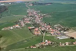 Aerial view | |
 Flag  Coat of arms | |
 Habřina Location in the Czech Republic | |
| Coordinates: 50°19′34″N 15°49′37″E / 50.32611°N 15.82694°E | |
| Country | |
| Region | Hradec Králové |
| District | Hradec Králové |
| First mentioned | 1357 |
| Area | |
• Total | 6.09 km2 (2.35 sq mi) |
| Elevation | 264 m (866 ft) |
| Population (2025-01-01)[1] | |
• Total | 315 |
| • Density | 52/km2 (130/sq mi) |
| Time zone | UTC+1 (CET) |
| • Summer (DST) | UTC+2 (CEST) |
| Postal code | 503 03 |
| Website | www |
Habřina is a municipality and village in Hradec Králové District in the Hradec Králové Region of the Czech Republic. It has about 300 inhabitants.
Demographics
| Year | Pop. | ±% |
|---|---|---|
| 1869 | 563 | — |
| 1880 | 635 | +12.8% |
| 1890 | 661 | +4.1% |
| 1900 | 574 | −13.2% |
| 1910 | 585 | +1.9% |
| 1921 | 565 | −3.4% |
| 1930 | 514 | −9.0% |
| 1950 | 323 | −37.2% |
| 1961 | 279 | −13.6% |
| 1970 | 272 | −2.5% |
| 1980 | 227 | −16.5% |
| 1991 | 219 | −3.5% |
| 2001 | 225 | +2.7% |
| 2011 | 310 | +37.8% |
| 2021 | 322 | +3.9% |
| Source: Censuses[2][3] | ||
References
- ^ "Population of Municipalities – 1 January 2025". Czech Statistical Office. 2025-05-16.
- ^ "Historický lexikon obcí České republiky 1869–2011" (in Czech). Czech Statistical Office. 2015-12-21.
- ^ "Population Census 2021: Population by sex". Public Database. Czech Statistical Office. 2021-03-27.
External links
Wikimedia Commons has media related to Habřina.