Káranice
Káranice | |
|---|---|
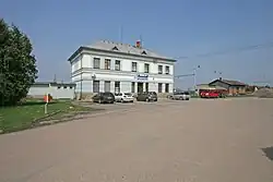 Train station | |
 Káranice Location in the Czech Republic | |
| Coordinates: 50°9′11″N 15°33′27″E / 50.15306°N 15.55750°E | |
| Country | |
| Region | Hradec Králové |
| District | Hradec Králové |
| First mentioned | 1429 |
| Area | |
• Total | 3.00 km2 (1.16 sq mi) |
| Elevation | 236 m (774 ft) |
| Population (2025-01-01)[1] | |
• Total | 216 |
| • Density | 72/km2 (190/sq mi) |
| Time zone | UTC+1 (CET) |
| • Summer (DST) | UTC+2 (CEST) |
| Postal code | 503 66 |
| Website | www |
Káranice is a municipality and village in Hradec Králové District in the Hradec Králové Region of the Czech Republic. It has about 200 inhabitants.
Demographics
| Year | Pop. | ±% |
|---|---|---|
| 1869 | 215 | — |
| 1880 | 220 | +2.3% |
| 1890 | 219 | −0.5% |
| 1900 | 238 | +8.7% |
| 1910 | 242 | +1.7% |
| 1921 | 245 | +1.2% |
| 1930 | 295 | +20.4% |
| 1950 | 213 | −27.8% |
| 1961 | 206 | −3.3% |
| 1970 | 203 | −1.5% |
| 1980 | 211 | +3.9% |
| 1991 | 173 | −18.0% |
| 2001 | 183 | +5.8% |
| 2011 | 187 | +2.2% |
| 2021 | 188 | +0.5% |
| Source: Censuses[2][3] | ||
References
- ^ "Population of Municipalities – 1 January 2025". Czech Statistical Office. 2025-05-16.
- ^ "Historický lexikon obcí České republiky 1869–2011" (in Czech). Czech Statistical Office. 2015-12-21.
- ^ "Population Census 2021: Population by sex". Public Database. Czech Statistical Office. 2021-03-27.
External links
Wikimedia Commons has media related to Káranice.