Horní Bělá
Horní Bělá | |
|---|---|
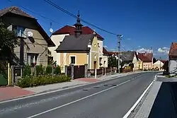 Centre of Horní Bělá | |
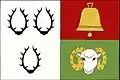 Flag 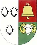 Coat of arms | |
 Horní Bělá Location in the Czech Republic | |
| Coordinates: 49°53′21″N 13°15′51″E / 49.88917°N 13.26417°E | |
| Country | |
| Region | Plzeň |
| District | Plzeň-North |
| First mentioned | 1318 |
| Area | |
• Total | 18.40 km2 (7.10 sq mi) |
| Elevation | 513 m (1,683 ft) |
| Population (2025-01-01)[1] | |
• Total | 593 |
| • Density | 32/km2 (83/sq mi) |
| Time zone | UTC+1 (CET) |
| • Summer (DST) | UTC+2 (CEST) |
| Postal code | 331 52 |
| Website | www |
Horní Bělá (German: Ober Biela) is a municipality and village in Plzeň-North District in the Plzeň Region of the Czech Republic. It has about 600 inhabitants.
Horní Bělá lies approximately 18 kilometres (11 mi) north-west of Plzeň and 87 kilometres (54 mi) west of Prague.
Administrative division
Horní Bělá consists of three municipal parts (in brackets population according to the 2021 census):[2]
- Horní Bělá (378)
- Hubenov (77)
- Tlucná (113)
Demographics
| Year | Pop. | ±% |
|---|---|---|
| 1869 | 782 | — |
| 1880 | 925 | +18.3% |
| 1890 | 912 | −1.4% |
| 1900 | 886 | −2.9% |
| 1910 | 932 | +5.2% |
| 1921 | 881 | −5.5% |
| 1930 | 939 | +6.6% |
| 1950 | 677 | −27.9% |
| 1961 | 691 | +2.1% |
| 1970 | 690 | −0.1% |
| 1980 | 624 | −9.6% |
| 1991 | 551 | −11.7% |
| 2001 | 553 | +0.4% |
| 2011 | 554 | +0.2% |
| 2021 | 568 | +2.5% |
| Source: Censuses[3][4] | ||
References
- ^ "Population of Municipalities – 1 January 2025". Czech Statistical Office. 2025-05-16.
- ^ "Public Census 2021 – basic data". Public Database (in Czech). Czech Statistical Office. 2022.
- ^ "Historický lexikon obcí České republiky 1869–2011" (in Czech). Czech Statistical Office. 2015-12-21.
- ^ "Population Census 2021: Population by sex". Public Database. Czech Statistical Office. 2021-03-27.
External links
Wikimedia Commons has media related to Horní Bělá.