Zahrádka (Plzeň-North District)
Zahrádka | |
|---|---|
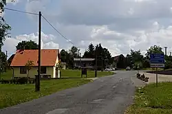 Centre of Zahrádka | |
 Flag 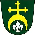 Coat of arms | |
 Zahrádka Location in the Czech Republic | |
| Coordinates: 49°52′51″N 13°12′42″E / 49.88083°N 13.21167°E | |
| Country | |
| Region | Plzeň |
| District | Plzeň-North |
| First mentioned | 1379 |
| Area | |
• Total | 15.33 km2 (5.92 sq mi) |
| Elevation | 525 m (1,722 ft) |
| Population (2025-01-01)[1] | |
• Total | 167 |
| • Density | 11/km2 (28/sq mi) |
| Time zone | UTC+1 (CET) |
| • Summer (DST) | UTC+2 (CEST) |
| Postal codes | 330 35, 330 38 |
| Website | www |
Zahrádka is a municipality and village in Plzeň-North District in the Plzeň Region of the Czech Republic. It has about 200 inhabitants.
Zahrádka lies approximately 20 kilometres (12 mi) north-west of Plzeň and 90 km (56 mi) west of Prague.
Administrative division
Zahrádka consists of three municipal parts (in brackets population according to the 2021 census):[2]
- Zahrádka (43)
- Hůrky (61)
- Mostice (29)
Demographics
| Year | Pop. | ±% |
|---|---|---|
| 1869 | 446 | — |
| 1880 | 434 | −2.7% |
| 1890 | 409 | −5.8% |
| 1900 | 375 | −8.3% |
| 1910 | 389 | +3.7% |
| 1921 | 392 | +0.8% |
| 1930 | 399 | +1.8% |
| 1950 | 222 | −44.4% |
| 1961 | 199 | −10.4% |
| 1970 | 197 | −1.0% |
| 1980 | 179 | −9.1% |
| 1991 | 153 | −14.5% |
| 2001 | 141 | −7.8% |
| 2011 | 140 | −0.7% |
| 2021 | 133 | −5.0% |
| Source: Censuses[3][4] | ||
References
- ^ "Population of Municipalities – 1 January 2025". Czech Statistical Office. 2025-05-16.
- ^ "Public Census 2021 – basic data". Public Database (in Czech). Czech Statistical Office. 2022.
- ^ "Historický lexikon obcí České republiky 1869–2011" (in Czech). Czech Statistical Office. 2015-12-21.
- ^ "Population Census 2021: Population by sex". Public Database. Czech Statistical Office. 2021-03-27.
External links
Wikimedia Commons has media related to Zahrádka (Plzeň-North District).