Horní Loděnice
Horní Loděnice | |
|---|---|
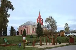 Church of Saint Isidore | |
 Flag  Coat of arms | |
 Horní Loděnice Location in the Czech Republic | |
| Coordinates: 49°46′16″N 17°22′38″E / 49.77111°N 17.37722°E | |
| Country | |
| Region | Olomouc |
| District | Olomouc |
| First mentioned | 1296 |
| Area | |
• Total | 18.19 km2 (7.02 sq mi) |
| Elevation | 543 m (1,781 ft) |
| Population (2025-01-01)[1] | |
• Total | 339 |
| • Density | 19/km2 (48/sq mi) |
| Time zone | UTC+1 (CET) |
| • Summer (DST) | UTC+2 (CEST) |
| Postal code | 783 05 |
| Website | www |
Horní Loděnice (until 1950 Německá Loděnice; German: Deutsch Lodenitz) is a municipality and village in Olomouc District in the Olomouc Region of the Czech Republic. It has about 300 inhabitants.
Horní Loděnice lies approximately 22 kilometres (14 mi) north-east of Olomouc and 214 km (133 mi) east of Prague.
Demographics
| Year | Pop. | ±% |
|---|---|---|
| 1869 | 984 | — |
| 1880 | 975 | −0.9% |
| 1890 | 922 | −5.4% |
| 1900 | 830 | −10.0% |
| 1910 | 798 | −3.9% |
| 1921 | 781 | −2.1% |
| 1930 | 778 | −0.4% |
| 1950 | 305 | −60.8% |
| 1961 | 376 | +23.3% |
| 1970 | 386 | +2.7% |
| 1980 | 309 | −19.9% |
| 1991 | 302 | −2.3% |
| 2001 | 336 | +11.3% |
| 2011 | 323 | −3.9% |
| 2021 | 300 | −7.1% |
| Source: Censuses[2][3] | ||
References
- ^ "Population of Municipalities – 1 January 2025". Czech Statistical Office. 2025-05-16.
- ^ "Historický lexikon obcí České republiky 1869–2011" (in Czech). Czech Statistical Office. 2015-12-21.
- ^ "Population Census 2021: Population by sex". Public Database. Czech Statistical Office. 2021-03-27.
External links
Wikimedia Commons has media related to Horní Loděnice.