Troubelice
Troubelice | |
|---|---|
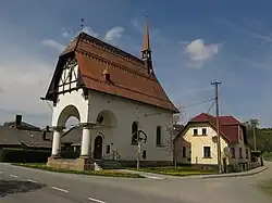 Chapel of Saint Anthony of Padua | |
 Flag  Coat of arms | |
 Troubelice Location in the Czech Republic | |
| Coordinates: 49°49′2″N 17°4′52″E / 49.81722°N 17.08111°E | |
| Country | |
| Region | Olomouc |
| District | Olomouc |
| First mentioned | 1334 |
| Area | |
• Total | 18.85 km2 (7.28 sq mi) |
| Elevation | 250 m (820 ft) |
| Population (2025-01-01)[1] | |
• Total | 1,843 |
| • Density | 98/km2 (250/sq mi) |
| Time zone | UTC+1 (CET) |
| • Summer (DST) | UTC+2 (CEST) |
| Postal code | 783 83 |
| Website | www |
Troubelice is a municipality and village in Olomouc District in the Olomouc Region of the Czech Republic. It has about 1,800 inhabitants.
Troubelice lies approximately 29 kilometres (18 mi) north-west of Olomouc and 193 km (120 mi) east of Prague.
Administrative division
Troubelice consists of four municipal parts (in brackets population according to the 2021 census):[2]
- Troubelice (1,256)
- Dědinka (56)
- Lazce (236)
- Pískov (198)
Demographics
| Year | Pop. | ±% |
|---|---|---|
| 1869 | 1,794 | — |
| 1880 | 1,951 | +8.8% |
| 1890 | 1,956 | +0.3% |
| 1900 | 1,947 | −0.5% |
| 1910 | 1,936 | −0.6% |
| 1921 | 1,996 | +3.1% |
| 1930 | 1,954 | −2.1% |
| 1950 | 1,505 | −23.0% |
| 1961 | 1,829 | +21.5% |
| 1970 | 1,783 | −2.5% |
| 1980 | 1,779 | −0.2% |
| 1991 | 1,716 | −3.5% |
| 2001 | 1,799 | +4.8% |
| 2011 | 1,840 | +2.3% |
| 2021 | 1,746 | −5.1% |
| Source: Censuses[3][4] | ||
References
- ^ "Population of Municipalities – 1 January 2025". Czech Statistical Office. 2025-05-16.
- ^ "Public Census 2021 – basic data". Public Database (in Czech). Czech Statistical Office. 2022.
- ^ "Historický lexikon obcí České republiky 1869–2011" (in Czech). Czech Statistical Office. 2015-12-21.
- ^ "Population Census 2021: Population by sex". Public Database. Czech Statistical Office. 2021-03-27.
External links
Wikimedia Commons has media related to Troubelice.