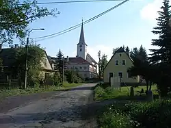
Hraničné Petrovice
Hraničné Petrovice | |
|---|---|
 Church of Saints Peter and Paul | |
 Flag  Coat of arms | |
 Hraničné Petrovice Location in the Czech Republic | |
| Coordinates: 49°44′27″N 17°24′18″E / 49.74083°N 17.40500°E | |
| Country | |
| Region | Olomouc |
| District | Olomouc |
| First mentioned | 1353 |
| Area | |
• Total | 12.17 km2 (4.70 sq mi) |
| Elevation | 587 m (1,926 ft) |
| Population (2025-01-01)[1] | |
• Total | 141 |
| • Density | 12/km2 (30/sq mi) |
| Time zone | UTC+1 (CET) |
| • Summer (DST) | UTC+2 (CEST) |
| Postal code | 783 06 |
| Website | www |
Hraničné Petrovice (German: Petersdorf) is a municipality and village in Olomouc District in the Olomouc Region of the Czech Republic. It has about 100 inhabitants.
Hraničné Petrovice lies approximately 19 kilometres (12 mi) north-east of Olomouc and 217 km (135 mi) east of Prague.
Demographics
| Year | Pop. | ±% |
|---|---|---|
| 1869 | 469 | — |
| 1880 | 470 | +0.2% |
| 1890 | 435 | −7.4% |
| 1900 | 462 | +6.2% |
| 1910 | 468 | +1.3% |
| 1921 | 446 | −4.7% |
| 1930 | 393 | −11.9% |
| 1950 | 251 | −36.1% |
| 1961 | 253 | +0.8% |
| 1970 | 240 | −5.1% |
| 1980 | 205 | −14.6% |
| 1991 | 164 | −20.0% |
| 2001 | 148 | −9.8% |
| 2011 | 134 | −9.5% |
| 2021 | 133 | −0.7% |
| Source: Censuses[2][3] | ||
References
- ^ "Population of Municipalities – 1 January 2025". Czech Statistical Office. 2025-05-16.
- ^ "Historický lexikon obcí České republiky 1869–2011" (in Czech). Czech Statistical Office. 2015-12-21.
- ^ "Population Census 2021: Population by sex". Public Database. Czech Statistical Office. 2021-03-27.
External links
Wikimedia Commons has media related to Hraničné Petrovice.