Hraběšice
Hraběšice | |
|---|---|
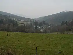 View from the east | |
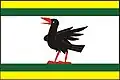 Flag 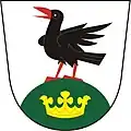 Coat of arms | |
 Hraběšice Location in the Czech Republic | |
| Coordinates: 49°58′36″N 17°4′46″E / 49.97667°N 17.07944°E | |
| Country | |
| Region | Olomouc |
| District | Šumperk |
| First mentioned | 1569 |
| Area | |
• Total | 8.23 km2 (3.18 sq mi) |
| Elevation | 530 m (1,740 ft) |
| Population (2025-01-01)[1] | |
• Total | 207 |
| • Density | 25/km2 (65/sq mi) |
| Time zone | UTC+1 (CET) |
| • Summer (DST) | UTC+2 (CEST) |
| Postal codes | 788 15 |
| Website | www |
Hraběšice (German: Rabenseifen) is a municipality and village in Šumperk District in the Olomouc Region of the Czech Republic. It has about 200 inhabitants.
Hraběšice lies approximately 8 kilometres (5 mi) east of Šumperk, 44 km (27 mi) north of Olomouc, and 191 km (119 mi) east of Prague.
Demographics
| Year | Pop. | ±% |
|---|---|---|
| 1869 | 727 | — |
| 1880 | 751 | +3.3% |
| 1890 | 707 | −5.9% |
| 1900 | 639 | −9.6% |
| 1910 | 566 | −11.4% |
| 1921 | 479 | −15.4% |
| 1930 | 461 | −3.8% |
| 1950 | 202 | −56.2% |
| 1961 | 234 | +15.8% |
| 1970 | 157 | −32.9% |
| 1980 | 103 | −34.4% |
| 1991 | 63 | −38.8% |
| 2001 | 101 | +60.3% |
| 2011 | 129 | +27.7% |
| 2021 | 180 | +39.5% |
| Source: Censuses[2][3] | ||
References
- ^ "Population of Municipalities – 1 January 2025". Czech Statistical Office. 2025-05-16.
- ^ "Historický lexikon obcí České republiky 1869–2011" (in Czech). Czech Statistical Office. 2015-12-21.
- ^ "Population Census 2021: Population by sex". Public Database. Czech Statistical Office. 2021-03-27.
External links
Wikimedia Commons has media related to Hraběšice.