Hrabišín
Hrabišín | |
|---|---|
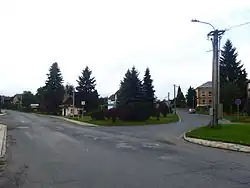 Centre of Hrabišín | |
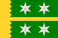 Flag 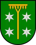 Coat of arms | |
 Hrabišín Location in the Czech Republic | |
| Coordinates: 49°54′51″N 17°2′11″E / 49.91417°N 17.03639°E | |
| Country | |
| Region | Olomouc |
| District | Šumperk |
| First mentioned | 1352 |
| Area | |
• Total | 13.85 km2 (5.35 sq mi) |
| Elevation | 320 m (1,050 ft) |
| Population (2025-01-01)[1] | |
• Total | 862 |
| • Density | 62/km2 (160/sq mi) |
| Time zone | UTC+1 (CET) |
| • Summer (DST) | UTC+2 (CEST) |
| Postal codes | 788 04 |
| Website | www |
Hrabišín (German: Rabersdorf) is a municipality and village in Šumperk District in the Olomouc Region of the Czech Republic. It has about 900 inhabitants.
Hrabišín lies approximately 7 kilometres (4 mi) south-east of Šumperk, 40 km (25 mi) north-west of Olomouc, and 188 km (117 mi) east of Prague.
Demographics
| Year | Pop. | ±% |
|---|---|---|
| 1869 | 1,428 | — |
| 1880 | 1,489 | +4.3% |
| 1890 | 1,636 | +9.9% |
| 1900 | 1,644 | +0.5% |
| 1910 | 1,493 | −9.2% |
| 1921 | 1,345 | −9.9% |
| 1930 | 1,416 | +5.3% |
| 1950 | 901 | −36.4% |
| 1961 | 954 | +5.9% |
| 1970 | 848 | −11.1% |
| 1980 | 862 | +1.7% |
| 1991 | 806 | −6.5% |
| 2001 | 844 | +4.7% |
| 2011 | 849 | +0.6% |
| 2021 | 765 | −9.9% |
| Source: Censuses[2][3] | ||
References
- ^ "Population of Municipalities – 1 January 2025". Czech Statistical Office. 2025-05-16.
- ^ "Historický lexikon obcí České republiky 1869–2011" (in Czech). Czech Statistical Office. 2015-12-21.
- ^ "Population Census 2021: Population by sex". Public Database. Czech Statistical Office. 2021-03-27.
External links
Wikimedia Commons has media related to Hrabišín.