Jamkhed taluka
Jamkhed taluka | |
|---|---|
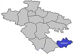 Location of Jamkhed in Ahmednagar district in Maharashtra | |
| Country | |
| State | Maharashtra |
| District | Ahmednagar |
| Headquarters | Karjat |
| Area | |
• Total | 878.62 km2 (339.24 sq mi) |
| Population (2011) | |
• Total | 158,380 |
| • Density | 180/km2 (470/sq mi) |
| Demographics | |
| • Literacy rate | 63.69% |
| • Sex ratio | 1.05 ♂/♀ |
| Website | Official website |
Jamkhed taluka, is a taluka in Karjat subdivision of Ahmednagar district in Maharashtra State of India.[1]
Area
The table below shows area of the taluka by land type.[2]
| Type of Land | Area (km2) | % of Total Area |
|---|---|---|
| Agriculture | 734.5 | 83.6 |
| Forest | 37.72 | 4.29 |
| Other | 106.4 | 12.11 |
| Total | 878.62 | 100 |
Villages
There are around 88 villages in Jamkhed taluka. For list of villages see Villages in Jamkhed taluka.
Population
Jamkhed taluka has a population of 158,380 according to the 2011 census. Jamkhed had a literacy rate of 63.69% and a sex ratio of 920 females per 1000 males. 34,017 (21.48%) lived in urban areas. Scheduled Castes and Scheduled Tribes make up 12.99% and 1.43% of the population respectively.[4]
At the time of the 2011 Census of India, 90.09% of the population in the district spoke Marathi, 3.87% Hindi and 3.67% Urdu as their first language.[5]
Rain Fall
The Table below details of rainfall from year 1981 to 2004.[6]
| Year | Rainfall (mm) |
|---|---|
| 1981 | 527 |
| 1982 | 555 |
| 1983 | 1341 |
| 1984 | 727 |
| 1985 | 540 |
| 1986 | 872 |
| 1987 | 996 |
| 1988 | 1040 |
| 1989 | 920 |
| 1990 | 523 |
| 1991 | 480 |
| 1993 | 823 |
| 1994 | 583.3 |
| 1995 | 570 |
| 1996 | 922 |
| 1997 | 427 |
| 1998 | 1070 |
| 1999 | 409 |
| 2000 | 661 |
| 2001 | 333 |
| 2002 | 561 |
| 2003 | 460 |
| 2004 | 570 |
See also
References
- ^ "Talukas in Ahmednagar district". Archived from the original on 29 September 2011. Retrieved 22 September 2010.
- ^ "Talukas geographic information". Archived from the original on 29 September 2011. Retrieved 22 September 2010.
- ^ "Table C-01 Population by Religion: Maharashtra". censusindia.gov.in. Registrar General and Census Commissioner of India. 2011.
- ^ "District Census Hand Book – Ahmednagar" (PDF). Census of India. Registrar General and Census Commissioner of India.
- ^ a b "Table C-16 Population by Mother Tongue: Maharashtra". censusindia.gov.in. Registrar General and Census Commissioner of India.
- ^ "Rainfall information of Ahemadnagar district". Archived from the original on 8 December 2015. Retrieved 22 September 2010.
Ahmednagar district topics | ||
|---|---|---|
| History | .svg.png) | |
| Geography | ||
| Talukas | ||
| Cities and towns | ||
| Monuments | ||
| Education | ||
| Lok Sabha constituencies | ||
| Vidhan Sabha constituencies | ||
| Dams in District | ||