Jasenná (Náchod District)
Jasenná | |
|---|---|
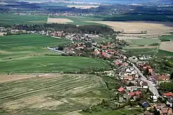 Aerial view | |
_Flag.jpg) Flag _CoA.png) Coat of arms | |
 Jasenná Location in the Czech Republic | |
| Coordinates: 50°19′6″N 15°59′28″E / 50.31833°N 15.99111°E | |
| Country | |
| Region | Hradec Králové |
| District | Náchod |
| First mentioned | 1305 |
| Area | |
• Total | 12.74 km2 (4.92 sq mi) |
| Elevation | 270 m (890 ft) |
| Population (2025-01-01)[1] | |
• Total | 731 |
| • Density | 57/km2 (150/sq mi) |
| Time zone | UTC+1 (CET) |
| • Summer (DST) | UTC+2 (CEST) |
| Postal code | 552 22 |
| Website | www |
Jasenná is a municipality and village in Náchod District in the Hradec Králové Region of the Czech Republic. It has about 700 inhabitants.
Demographics
| Year | Pop. | ±% |
|---|---|---|
| 1869 | 1,180 | — |
| 1880 | 1,360 | +15.3% |
| 1890 | 1,317 | −3.2% |
| 1900 | 1,257 | −4.6% |
| 1910 | 1,354 | +7.7% |
| 1921 | 1,352 | −0.1% |
| 1930 | 1,193 | −11.8% |
| 1950 | 912 | −23.6% |
| 1961 | 894 | −2.0% |
| 1970 | 809 | −9.5% |
| 1980 | 764 | −5.6% |
| 1991 | 695 | −9.0% |
| 2001 | 696 | +0.1% |
| 2011 | 695 | −0.1% |
| 2021 | 736 | +5.9% |
| Source: Censuses[2][3] | ||
References
- ^ "Population of Municipalities – 1 January 2025". Czech Statistical Office. 2025-05-16.
- ^ "Historický lexikon obcí České republiky 1869–2011" (in Czech). Czech Statistical Office. 2015-12-21.
- ^ "Population Census 2021: Population by sex". Public Database. Czech Statistical Office. 2021-03-27.
External links
Wikimedia Commons has media related to Jasenná (Náchod District).