Libchyně
Libchyně | |
|---|---|
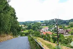 View from the west | |
 Flag  Coat of arms | |
 Libchyně Location in the Czech Republic | |
| Coordinates: 50°21′25″N 16°11′27″E / 50.35694°N 16.19083°E | |
| Country | |
| Region | Hradec Králové |
| District | Náchod |
| First mentioned | 1459 |
| Area | |
• Total | 1.19 km2 (0.46 sq mi) |
| Elevation | 408 m (1,339 ft) |
| Population (2025-01-01)[1] | |
• Total | 68 |
| • Density | 57/km2 (150/sq mi) |
| Time zone | UTC+1 (CET) |
| • Summer (DST) | UTC+2 (CEST) |
| Postal code | 549 01 |
| Website | www |
Libchyně is a municipality and village in Náchod District in the Hradec Králové Region of the Czech Republic. It has about 70 inhabitants.
Demographics
| Year | Pop. | ±% |
|---|---|---|
| 1869 | 310 | — |
| 1880 | 274 | −11.6% |
| 1890 | 284 | +3.6% |
| 1900 | 274 | −3.5% |
| 1910 | 248 | −9.5% |
| 1921 | 228 | −8.1% |
| 1930 | 222 | −2.6% |
| 1950 | 191 | −14.0% |
| 1961 | 176 | −7.9% |
| 1970 | 137 | −22.2% |
| 1980 | 97 | −29.2% |
| 1991 | 71 | −26.8% |
| 2001 | 68 | −4.2% |
| 2011 | 61 | −10.3% |
| 2021 | 61 | +0.0% |
| Source: Censuses[2][3] | ||
References
- ^ "Population of Municipalities – 1 January 2025". Czech Statistical Office. 2025-05-16.
- ^ "Historický lexikon obcí České republiky 1869–2011" (in Czech). Czech Statistical Office. 2015-12-21.
- ^ "Population Census 2021: Population by sex". Public Database. Czech Statistical Office. 2021-03-27.
External links
Wikimedia Commons has media related to Libchyně.