Slatina nad Úpou
Slatina nad Úpou | |
|---|---|
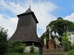 Bell tower | |
 Flag  Coat of arms | |
 Slatina nad Úpou Location in the Czech Republic | |
| Coordinates: 50°27′15″N 16°2′12″E / 50.45417°N 16.03667°E | |
| Country | |
| Region | Hradec Králové |
| District | Náchod |
| First mentioned | 1545 |
| Area | |
• Total | 10.11 km2 (3.90 sq mi) |
| Elevation | 372 m (1,220 ft) |
| Population (2025-01-01)[1] | |
• Total | 313 |
| • Density | 31/km2 (80/sq mi) |
| Time zone | UTC+1 (CET) |
| • Summer (DST) | UTC+2 (CEST) |
| Postal code | 549 47 |
| Website | www |
Slatina nad Úpou (German: Moorgrund an der Aupa) is a municipality and village in Náchod District in the Hradec Králové Region of the Czech Republic. It has about 300 inhabitants. It lies on the Úpa River.
Demographics
| Year | Pop. | ±% |
|---|---|---|
| 1869 | 1,301 | — |
| 1880 | 1,311 | +0.8% |
| 1890 | 1,292 | −1.4% |
| 1900 | 1,148 | −11.1% |
| 1910 | 1,089 | −5.1% |
| 1921 | 973 | −10.7% |
| 1930 | 899 | −7.6% |
| 1950 | 617 | −31.4% |
| 1961 | 490 | −20.6% |
| 1970 | 419 | −14.5% |
| 1980 | 374 | −10.7% |
| 1991 | 320 | −14.4% |
| 2001 | 297 | −7.2% |
| 2011 | 291 | −2.0% |
| 2021 | 312 | +7.2% |
| Source: Censuses[2][3] | ||
References
- ^ "Population of Municipalities – 1 January 2025". Czech Statistical Office. 2025-05-16.
- ^ "Historický lexikon obcí České republiky 1869–2011" (in Czech). Czech Statistical Office. 2015-12-21.
- ^ "Population Census 2021: Population by sex". Public Database. Czech Statistical Office. 2021-03-27.
External links
Wikimedia Commons has media related to Slatina nad Úpou.