Kařízek
Kařízek | |
|---|---|
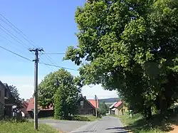 Main street | |
 Kařízek Location in the Czech Republic | |
| Coordinates: 49°48′48″N 13°47′59″E / 49.81333°N 13.79972°E | |
| Country | |
| Region | Plzeň |
| District | Rokycany |
| First mentioned | 1398 |
| Area | |
• Total | 4.45 km2 (1.72 sq mi) |
| Elevation | 508 m (1,667 ft) |
| Population (2025-01-01)[1] | |
• Total | 51 |
| • Density | 11/km2 (30/sq mi) |
| Time zone | UTC+1 (CET) |
| • Summer (DST) | UTC+2 (CEST) |
| Postal code | 338 08 |
| Website | www |
Kařízek is a municipality and village in Rokycany District in the Plzeň Region of the Czech Republic. It has about 50 inhabitants.
Kařízek lies approximately 18 kilometres (11 mi) north-east of Rokycany, 32 km (20 mi) east of Plzeň, and 54 km (34 mi) south-west of Prague.
Demographics
| Year | Pop. | ±% |
|---|---|---|
| 1869 | 210 | — |
| 1880 | 216 | +2.9% |
| 1890 | 188 | −13.0% |
| 1900 | 186 | −1.1% |
| 1910 | 188 | +1.1% |
| 1921 | 218 | +16.0% |
| 1930 | 210 | −3.7% |
| 1950 | 208 | −1.0% |
| 1961 | 99 | −52.4% |
| 1970 | 98 | −1.0% |
| 1980 | 73 | −25.5% |
| 1991 | 51 | −30.1% |
| 2001 | 42 | −17.6% |
| 2011 | 46 | +9.5% |
| 2021 | 56 | +21.7% |
| Source: Censuses[2][3] | ||
Transport
Kařížek is served by the Kařízek station on the regional railway line Plzeň–Beroun.[4] However, this station is located just beyond the municipal border.
References
- ^ "Population of Municipalities – 1 January 2025". Czech Statistical Office. 2025-05-16.
- ^ "Historický lexikon obcí České republiky 1869–2011" (in Czech). Czech Statistical Office. 2015-12-21.
- ^ "Population Census 2021: Population by sex". Public Database. Czech Statistical Office. 2021-03-27.
- ^ "Detail stanice Kařížek" (in Czech). České dráhy. Retrieved 2024-03-27.
External links
Wikimedia Commons has media related to Kařízek.